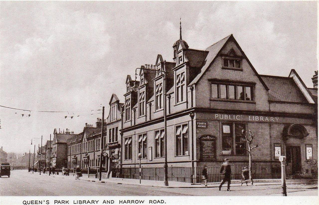
Fourth Avenue, W10
Road in/near Queens Park Estate, existing between 1874 and now.
| Fourth Avenue, W10 Road in/near Queens Park Estate, existing between 1874 and now. |
| HOME | · | ARTICLE | · | MAPS | · | STREETS | · | BLOG | · | CONTACT US |
| MAP YEAR: | 1750 | 1800 | 1810 | 1820 | 1830 | 1860 | 1900 | 1950 | 2024 | Show map without markers |
| Use the control in the top right of the map above to view this area on another historic map | ||||||||||
| Main source: | A History of the County of Middlesex | British History Online |
| Further citations and sources |
| Click here to explore another London street We now have 666 completed street histories and 46834 partial histories Find streets or residential blocks within the M25 by clicking STREETS |
| CONTRIBUTIONS TO THE LOCALITY |
  Fumblina Added: 27 Mar 2021 11:13 GMT | St Jude’s Church, Lancefield Street Saint Jude’s was constructed in 1878, while the parish was assigned in 1879 from the parish of Saint John, Kensal Green (P87/JNE2). The parish was united with the parishes of Saint Luke (P87/LUK1) and Saint Simon (P87/SIM) in 1952. The church was used as a chapel of ease for a few years, but in 1959 it was closed and later demolished. The church is visible on the 1900 map for the street on the right hand side above the junction with Mozart Street. Source: SAINT JUDE, KENSAL GREEN: LANCEFIELD STREET, WESTMINSTER | Londo Reply |
 Fumblina Added: 27 Mar 2021 11:08 GMT | Wedding at St Jude’s Church On 9th November 1884 Charles Selby and Johanna Hanlon got married in St Jude’s Church on Lancefield Street. They lived together close by at 103 Lancefield Street. Charles was a Lather, so worked in construction. He was only 21 but was already a widower. Johanna is not shown as having a profession but this is common in the records and elsewhere she is shown as being an Ironer or a Laundress. It is possible that she worked at the large laundry shown at the top of Lancefield Road on the 1900 map. She was also 21. She was not literate as her signature on the record is a cross. The ceremony was carried out by William Hugh Wood and was witnessed by Charles H Hudson and Caroline Hudson. Source: https://www.ancestry.co.uk/imageviewer/collections/1623/images/31280_197456-00100?pId=6694792 Reply |
  Dave Fahey Added: 6 Jan 2021 02:40 GMT | Bombing of the Jack O Newberry My maternal grandfather, Archie Greatorex, was the licensee of the Earl of Warwick during the Second World War. My late mother Vera often told the story of the bombing of the Jack. The morning after the pub was bombed, the landlord’s son appeared at the Warwick with the pub’s till on an old pram; he asked my grandfather to pay the money into the bank for him. The poor soul was obviously in shock. The previous night, his parents had taken their baby down to the pub cellar to shelter from the air raids. The son, my mother never knew his name, opted to stay in his bedroom at the top of the building. He was the only survivor. I often wondered what became of him. Reply |
  Scott Hatton Added: 11 Sep 2020 15:38 GMT | 6 East Row (1960 - 1960) We lived at 6 East Row just before it was demolished. Reply |
 danny currie Added: 30 Nov 2022 18:39 GMT | dads yard ron currie had a car breaking yard in millers yard back in the 60s good old days Reply |
 Added: 4 Sep 2022 15:42 GMT | Superman 2 I worked here in 1977. The scene in the prison laundry in Superman 2 was filmed here. Reply |
 CydKB Added: 31 Mar 2023 15:07 GMT | BlackJack Playground Emslie Horniman’s Pleasance was my favourite childhood park.I went to St Mary’s Catholic school, East Row from Nursery all the way through to Year 6 before Secondary School and I was taken here to play most days. There was a centre piece flower bed in the Voysey Garden surrounded by a pond which my classmates and I used to jump over when no one was looking. The Black jack playground was the go to playground for our sports days and my every day shortcut to get close to the half penny steps foot bridge via Kensal Road. There was also a shop where we could buy ice lollies on hot summer days.The Southern Row side of the Park was filled with pebbles which used to be so fun to walk through as a child, I used to walk through the deepness of the pebbles to get to Bosworth Road or east towards Hornimans Adventure Park. Reply |
 donna Added: 25 Jan 2021 13:25 GMT | Ladbroke Dwellings Three generations of my family lived along this row of dwellings, ’Ladbroke Dwellings’. All the men who lived there worked at the Gasworks. Among the shops you mention was Wilson’s sweet shop run by Maggie and her sister, and Johns grocery store. I believe there was also a photograph studio there too. Reply |
Patricia Bridges Added: 19 Jul 2021 10:57 GMT | Lancefield Coachworks My grandfather Tom Murray worked here Reply |
 Watts Added: 17 May 2022 20:29 GMT | Baeethoven St School, also an Annex for Paddington College of FE. In the early 70’s I took a two year science course at Paddington CFE. The science classes were held on weekday evenings at Beethoven Street school, overseen by chemistry teacher, Mr Tattershall. Reply |
Added: 14 Jan 2022 03:06 GMT | Goldbourne Gardens W 10 I lived in Goldbourne Gardens in the 50,s very happy big bomb site Reply |
 PeteR Added: 24 Jul 2023 12:41 GMT | Correction of street name Text mentions Embrook Street on Queen’s Park Estate. It should read Enbrook Street Reply |
  Sean Farrell Added: 13 Feb 2024 10:09 GMT | Jack of Newbury His name was Thomas Mathews. He was not the son, but son-in-law (or possibly brother-in-law) to Catherine Bond, wife of the licensee, William. He was a taxi driver before and after the war and eventually took on a pub in Bedfordshire in the 1960’s. He died in 1984. It was information from his nephew that I heard about his escape from the rubble of the pub. Reply |
| LATEST LONDON-WIDE CONTRIBUTIONS TO THE PROJECT |
Tony Whipple Added: 16 Apr 2024 21:35 GMT | Frank Whipple Place, E14 Frank was my great-uncle, I’d often be ’babysat’ by Peggy while Nan and Dad went to the pub. Peggy was a marvel, so full of life. My Dad and Frank didn’t agree on most politics but everyone in the family is proud of him. A genuinely nice, knowledgable bloke. One of a kind. Reply |
 Theresa Penney Added: 16 Apr 2024 18:08 GMT | 1 Whites Row My 2 x great grandparents and his family lived here according to the 1841 census. They were Dutch Ashkenazi Jews born in Amsterdam at the beginning of the 19th century but all their children were born in Spitalfields. Reply |
Wendy Added: 22 Mar 2024 15:33 GMT | Polygon Buildings Following the demolition of the Polygon, and prior to the construction of Oakshott Court in 1974, 4 tenement type blocks of flats were built on the site at Clarendon Sq/Phoenix Rd called Polygon Buildings. These were primarily for people working for the Midland Railway and subsequently British Rail. My family lived for 5 years in Block C in the 1950s. It seems that very few photos exist of these buildings. Reply |
  Steve Added: 19 Mar 2024 08:42 GMT | Road construction and houses completed New Charleville Circus road layout shown on Stanford’s Library Map Of London And Its Suburbs 1879 with access via West Hill only. Plans showing street numbering were recorded in 1888 so we can concluded the houses in Charleville Circus were built by this date. Source: Charleville Circus, Sydenham, London Reply |
Steve Added: 19 Mar 2024 08:04 GMT | Charleville Circus, Sydenham: One Place Study (OPS) One Place Study’s (OPS) are a recent innovation to research and record historical facts/events/people focused on a single place �’ building, street, town etc. I have created an open access OPS of Charleville Circus on WikiTree that has over a million members across the globe working on a single family tree for everyone to enjoy, for free, forever. Source: Charleville Circus, Sydenham, London Reply |
Charles Added: 8 Mar 2024 20:45 GMT | My House I want to know who lived in my house in the 1860’s. Reply |
 NH Added: 7 Mar 2024 11:41 GMT | Telephone House Donald Hunter House, formerly Telephone House, was the BT Offices closed in 2000 Reply |
Paul Cox Added: 5 Mar 2024 22:18 GMT | War damage reinstatement plans of No’s 11 & 13 Aldine Street Whilst clearing my elderly Mothers house of general detritus, I’ve come across original plans (one on acetate) of No’s 11 & 13 Aldine Street. Might they be of interest or should I just dispose of them? There are 4 copies seemingly from the one single acetate example. Seems a shame to just junk them as the level of detail is exquisite. No worries if of no interest, but thought I’d put it out there. Reply |
| LOCAL PHOTOS |