Albert Bridge

Bridge in/near Chelsea, existing between 1873 and now.

 HOME  ·  ARTICLE  ·  MAPS  ·  STREETS  ·  BLOG  ·  CONTACT US 
(51.483 -0.167, 51.483 -0.167) 
MAP YEAR:175018001810182018301860190019502024Show map without markers
Use the control in the top right of the map above to view this area on another historic map
 
Bridge · * · SW3 ·
July
29
2017
Albert Bridge was designed and built by Rowland Mason Ordish in 1873 as an Ordish–Lefeuvre system modified cable-stayed bridge.

Albert Bridge proved to be structurally unsound, so between 1884 and 1887 Sir Joseph Bazalgette incorporated some of the design elements of a suspension bridge. In 1973 the Greater London Council added two concrete piers, which transformed the central span into a simple beam bridge. As a result, today the bridge is an unusual hybrid of three different design styles.

Built as a toll bridge by a Mr Geoffrey Marks, it was commercially unsuccessful. Six years after its opening it was taken into public ownership and the tolls were lifted. The tollbooths remained in place and are the only surviving examples of bridge tollbooths in London. Nicknamed "The Trembling Lady" because of its tendency to vibrate when large numbers of people walked over it, the bridge has signs at its entrances that warn troops to break step whilst crossing the bridge.

The bridge was ill-equipped to cope with the advent of the motor vehicle during the 20th century. Despite many calls for its demolition or pedestrianisation, it is one of only two Thames road bridges in central London never to have been replaced (the other is Tower Bridge).

In 1992, Albert Bridge was rewired and painted in an unusual colour scheme designed to make it more conspicuous in poor visibility, and avoid being damaged by ships.


Main source: Wikipedia
Further citations and sources


Click here to explore another London street
We now have 666 completed street histories and 46834 partial histories
Find streets or residential blocks within the M25 by clicking STREETS


CONTRIBUTIONS TO THE LOCALITY

Lived here
   
Added: 1 May 2021 16:46 GMT   

Cheyne Place, SW3
Frances Faviell, author of the Blitz memoir, "A Chelsea Concerto", lived at 33, Cheyne Place, which was destroyed by a bomb. She survived, with her husband and unborn baby.

Reply

LATEST LONDON-WIDE CONTRIBUTIONS TO THE PROJECT

Comment
Wendy    
Added: 22 Mar 2024 15:33 GMT   

Polygon Buildings
Following the demolition of the Polygon, and prior to the construction of Oakshott Court in 1974, 4 tenement type blocks of flats were built on the site at Clarendon Sq/Phoenix Rd called Polygon Buildings. These were primarily for people working for the Midland Railway and subsequently British Rail. My family lived for 5 years in Block C in the 1950s. It seems that very few photos exist of these buildings.

Reply

Steve   
Added: 19 Mar 2024 08:42 GMT   

Road construction and houses completed
New Charleville Circus road layout shown on Stanford’s Library Map Of London And Its Suburbs 1879 with access via West Hill only.

Plans showing street numbering were recorded in 1888 so we can concluded the houses in Charleville Circus were built by this date.

Source: Charleville Circus, Sydenham, London

Reply
Comment
Steve   
Added: 19 Mar 2024 08:04 GMT   

Charleville Circus, Sydenham: One Place Study (OPS)
One Place Study’s (OPS) are a recent innovation to research and record historical facts/events/people focused on a single place �’ building, street, town etc.

I have created an open access OPS of Charleville Circus on WikiTree that has over a million members across the globe working on a single family tree for everyone to enjoy, for free, forever.

Source: Charleville Circus, Sydenham, London

Reply
Comment
Charles   
Added: 8 Mar 2024 20:45 GMT   

My House
I want to know who lived in my house in the 1860’s.

Reply

NH   
Added: 7 Mar 2024 11:41 GMT   

Telephone House
Donald Hunter House, formerly Telephone House, was the BT Offices closed in 2000

Reply
Comment
Paul Cox   
Added: 5 Mar 2024 22:18 GMT   

War damage reinstatement plans of No’s 11 & 13 Aldine Street
Whilst clearing my elderly Mothers house of general detritus, I’ve come across original plans (one on acetate) of No’s 11 & 13 Aldine Street. Might they be of interest or should I just dispose of them? There are 4 copies seemingly from the one single acetate example. Seems a shame to just junk them as the level of detail is exquisite. No worries if of no interest, but thought I’d put it out there.

Reply
Comment
Diana   
Added: 28 Feb 2024 13:52 GMT   

New Inn Yard, E1
My great grandparents x 6 lived in New Inn Yard. On this date, their son was baptised in nearby St Leonard’s Church, Shoreditch

Source: BDM London, Cripplegate and Shoreditch registers written by church clerk.

Reply
Comment
Vic Stanley   
Added: 24 Feb 2024 17:38 GMT   

Postcose
The postcode is SE15, NOT SE1

Reply


LOCAL PHOTOS
Click here to see map view of nearby Creative Commons images
Click here to see Creative Commons images near to this postcode
Petworth Street sign
TUM image id: 1493989872
Licence:
Royal Hospital, Chelsea
TUM image id: 1524258791
Licence: CC BY 2.0

In the neighbourhood...

Click an image below for a better view...
Battersea Bridge (1860s) James Hedderly was a photographer active in Chelsea before the building of the Embankment and afterwards. This is a view taken from the tower of Chelsea Old Church. It shows the tangle of closely-packed houses and wharves between Cheyne Walk and Beaufort Street before the embankment. Beyond are the larger houses of Lindsey Row and the trees of Cremorne Gardens.
Credit: James Hedderly
Licence:


The Fascination of Chelsea
Licence:


Tite Street, SW3 (1955) Playing in the street wasn’t an activity confined to Chelsea’s mean streets as this view of Tite Street shows. Baseball is being played here. In spotted dressed and suit trousers, the young (possibly American) boys and girls look dashing as they frolic around under the sun peaking through the trees. Tite Street was formerly home to Oscar Wilde and James McNeill Whistler.
Credit: John Bignell
Licence:


Rosenau Road, SW11 Schloss Rosenau is a castle, formerly in Saxe-Coburg, now lying in Bavaria. Schloss Rosenau was the boyhood home of Prince Albert of Saxe-Coburg and Gotha, who became the husband of Queen Victoria. Due to the name of nearby Albert Bridge, builders rook the opportunity to call many of the roads of this area of Battersea after connections with the Prince Consort.
Credit: The Underground Map
Licence:


Old Battersea Bridge, Walter Greaves (oil on canvas, 1874) Old Battersea Bridge, seen from upstream, on Lindsey Row (now Cheyne Walk), with Battersea on the far shore. The boatyard belonging to the Greaves family is in the foreground. On the extreme left is the wall surrounding the garden of the artist William Bell Scott. In the far distance Crystal Palace is just visible. Battersea Bridge was demolished in 1881, and replaced with the present bridge. Before the alterations Greaves recalled the danger to shipping and the difficulty of steering through the arches unless the ‘set of the tide was known’. On the horizon, Crystal Palace can be seen
Credit: Tate Gallery
Licence:


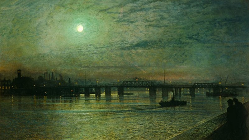
Battersea Bridge, a painting by John Atkinson Grimshaw (1885)
Credit: The Maas Gallery
Licence:


Justice Walk links Old Church Street and Lawrence Street. It has stayed relatively untouched, a reminder of early 19th century Chelsea. The cellar under the Wesleyan Chapel, seen on the right, was used as a soup kitchen for the poor. The chapel was relocated to the corner of Chelsea Manor Street and King’s Road circa 1900. H. Allen Smith, wine merchants, occupied the premise from 1903 to 1985. According to local legend, a courthouse with a gaol beneath occupied this site in 18th century. Prisoners were led through a tunnel to boats moored on the river to be transported to Australia.
Credit: William Walter Burgess c.1890
Licence: CC BY 2.0


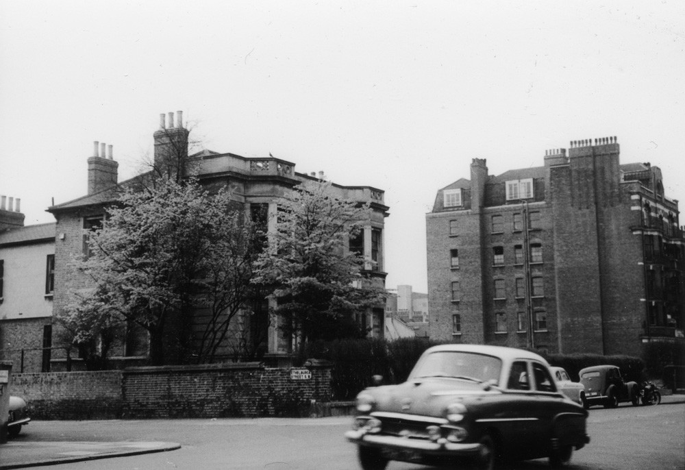
Albert Bridge Road at the former end of Ethelburga Street (1958)
Credit: Gwyneth Wexler
Licence: CC BY 2.0


  Contact us · Copyright policy · Privacy policy