St Magnus-the-Martyr

Church in/near City of London, existing until now.

 HOME  ·  ARTICLE  ·  MAPS  ·  STREETS  ·  BLOG  ·  CONTACT US 
(51.5093 -0.08634, 51.509 -0.086) 
MAP YEAR:175018001810182018301860190019502024Show map without markers
TIP: To see an article about a particular location, click one of the markers on the map
 
Church · * · ·
APRIL
15
2019
St Magnus the Martyr church is dedicated to St Magnus the Martyr, earl of Orkney, who died on 16 April 1116.

Archaeological evidence suggests that the area of London Bridge head was not occupied from the early 5th century until the early 10th century.

Environmental evidence indicates that the area was waste ground during this period, colonised by elder and nettles. Following Alfred’s decision to reoccupy the walled area of London in 886, new harbours were established at Queenhithe and Billingsgate. A bridge was in place by the early 11th century, a factor which would have encouraged the occupation of the bridgehead by craftsmen and traders.

St Magnus was built to the south of Thames Street to serve the growing population of the bridgehead area and was certainly in existence by 1128-33.

Until 1831, London Bridge was aligned with Fish Street Hill, so the main entrance into the City from the south passed the West door of St Magnus on the north bank of the river. The bridge included a chapel dedicated to St Thomas Becket for the use of pilgrims journeying to Canterbury Cathedral to visit his tomb. The chapel and about two thirds of the bridge were in the parish of St Magnus. The church jutted into the road running to the bridge and it grew in importance.

St Magnus Corner at the north end of London Bridge was an important meeting place in mediaeval London, where notices were exhibited, proclamations read out and wrongdoers punished. As it was conveniently close to the River Thames, the church was chosen by the Bishop between the 15th and 17th centuries as a convenient venue for general meetings of the clergy in his diocese.

The church had a series of distinguished rectors including Myles Coverdale (Rector 1564-66) who oversaw the production of the first complete bible in the English language.

St Magnus narrowly escaped destruction in 1633 in a fire that burned many buildings upon London Bridge but, despite this, the church was one of the first buildings to be destroyed in the Great Fire of London in 1666. St Magnus stood less than 300 yards from the bakehouse of Thomas Farriner in Pudding Lane where the fire started. Farriner, a former churchwarden of St Magnus, was buried in the middle aisle of the church on 11 December 1670, perhaps within a temporary structure erected for holding services.

The parish engaged the master mason George Dowdeswell to start the work of rebuilding in 1668. The work was carried forward between 1671 and 1687 under the direction of Sir Christopher Wren, the body of the church being substantially complete by 1676. At a cost of £9579 19s 10d, St Magnus was one of Wren’s most expensive churches.

Shortly before his death in 1711, Sir Charles Duncombe, Alderman for the Ward of Bridge Within and, in 1708/09, Lord Mayor of London, commissioned an organ for the church, the first to have a swell-box, by Abraham Jordan (father and son). A swell organ uses pipes set apart in a box which can be opened or closed to alter the volume. The organ case, which remains in its original state, is looked upon as one of the finest existing examples of the Grinling Gibbons’s school of wood carving.

Canaletto drew St Magnus and old London Bridge as they appeared in the late 1740s. Between 1756 and 1762, under the London Bridge Improvement Act of 1756, the Corporation of London demolished the buildings on London Bridge to widen the roadway, ease traffic congestion and improve safety for pedestrians.

As part of the bridge improvements, overseen by the architect Sir Robert Taylor, a new pedestrian walkway was built along the eastern side of the bridge. With the other buildings gone St Magnus blocked the new walkway. As a consequence it was necessary in 1762 to 1763 to remove the vestry rooms at the West end of the church and open up the side arches of the tower so that people could pass underneath the tower. The tower’s lower storey thus became an external porch.

By 1782 the noise level from the activities of Billingsgate Fish Market had become unbearable and the large windows on the north side of the church were blocked up leaving only circular windows high up in the wall.

In 1823 royal assent was given to ‘An Act for the Rebuilding of London Bridge’ and in 1825 John Garratt, Lord Mayor and Alderman of the Ward of Bridge Within, laid the first stone of the new London Bridge. In 1831 Sir John Rennie’s new bridge was opened further upstream and the old bridge demolished. St Magnus ceased to be the gateway to London as it had been for over 600 years.

Until 1922 the annual Fish Harvest Festival was celebrated at St Magnus. The service moved in 1923 to St Dunstan in the East, but St Magnus retained close links with the local fish merchants until the closure of old Billingsgate Market. St Magnus is the guild church of the Worshipful Company of Fishmongers and the Worshipful Company of Plumbers, and the ward church of the Ward of Bridge and Bridge Without.

A bomb which fell on London Bridge in 1940 during the Blitz blew out all the windows and damaged the plasterwork and the roof of the north aisle. However, the church was designated a Grade I listed building on 4 January 1950 and repaired in 1951, being re-opened for worship in June of that year by the Bishop of London.

By the early 1960s traffic congestion had become a problem and Lower Thames Street was widened over the next decade to form part of a significant new east-west transport artery. The setting of the church was further affected by the construction of a new London Bridge between 1967 and 1973.

St Magnus’s prominent location and beauty has prompted many mentions in literature. In Oliver Twist, Charles Dickens notes how, as Nancy heads for her secret meeting with Mr Brownlow and Rose Maylie on London Bridge, "the tower of old Saint Saviour’s Church, and the spire of Saint Magnus, so long the giant-warders of the ancient bridge, were visible in the gloom". The church’s spiritual and architectural importance is celebrated in the poem The Waste Land by T. S. Eliot, who adds in a footnote that "the interior of St. Magnus Martyr is to my mind one of the finest among Wren’s interiors".

Just inside the west door is a spectacular model of Old London Bridge.


Main source: Wikipedia, the free encyclopedia
Further citations and sources


Click here to explore another London street
We now have 666 completed street histories and 46834 partial histories
Find streets or residential blocks within the M25 by clicking STREETS


CONTRIBUTIONS TO THE LOCALITY

None so far :(
LATEST LONDON-WIDE CONTRIBUTIONS TO THE PROJECT

Comment
Tony Whipple   
Added: 16 Apr 2024 21:35 GMT   

Frank Whipple Place, E14
Frank was my great-uncle, I’d often be ’babysat’ by Peggy while Nan and Dad went to the pub. Peggy was a marvel, so full of life. My Dad and Frank didn’t agree on most politics but everyone in the family is proud of him. A genuinely nice, knowledgable bloke. One of a kind.

Reply
Comment
Theresa Penney   
Added: 16 Apr 2024 18:08 GMT   

1 Whites Row
My 2 x great grandparents and his family lived here according to the 1841 census. They were Dutch Ashkenazi Jews born in Amsterdam at the beginning of the 19th century but all their children were born in Spitalfields.

Reply
Comment
Wendy    
Added: 22 Mar 2024 15:33 GMT   

Polygon Buildings
Following the demolition of the Polygon, and prior to the construction of Oakshott Court in 1974, 4 tenement type blocks of flats were built on the site at Clarendon Sq/Phoenix Rd called Polygon Buildings. These were primarily for people working for the Midland Railway and subsequently British Rail. My family lived for 5 years in Block C in the 1950s. It seems that very few photos exist of these buildings.

Reply

Steve   
Added: 19 Mar 2024 08:42 GMT   

Road construction and houses completed
New Charleville Circus road layout shown on Stanford’s Library Map Of London And Its Suburbs 1879 with access via West Hill only.

Plans showing street numbering were recorded in 1888 so we can concluded the houses in Charleville Circus were built by this date.

Source: Charleville Circus, Sydenham, London

Reply
Comment
Steve   
Added: 19 Mar 2024 08:04 GMT   

Charleville Circus, Sydenham: One Place Study (OPS)
One Place Study’s (OPS) are a recent innovation to research and record historical facts/events/people focused on a single place �’ building, street, town etc.

I have created an open access OPS of Charleville Circus on WikiTree that has over a million members across the globe working on a single family tree for everyone to enjoy, for free, forever.

Source: Charleville Circus, Sydenham, London

Reply
Comment
Charles   
Added: 8 Mar 2024 20:45 GMT   

My House
I want to know who lived in my house in the 1860’s.

Reply

NH   
Added: 7 Mar 2024 11:41 GMT   

Telephone House
Donald Hunter House, formerly Telephone House, was the BT Offices closed in 2000

Reply
Comment
Paul Cox   
Added: 5 Mar 2024 22:18 GMT   

War damage reinstatement plans of No’s 11 & 13 Aldine Street
Whilst clearing my elderly Mothers house of general detritus, I’ve come across original plans (one on acetate) of No’s 11 & 13 Aldine Street. Might they be of interest or should I just dispose of them? There are 4 copies seemingly from the one single acetate example. Seems a shame to just junk them as the level of detail is exquisite. No worries if of no interest, but thought I’d put it out there.

Reply


LOCAL PHOTOS
Click here to see map view of nearby Creative Commons images
Click here to see Creative Commons images near to this postcode
Bank station
Credit: IG/steven.maddison
TUM image id: 1653840363
Licence: CC BY 2.0
Byward Tower, 1893
TUM image id: 1556882285
Licence: CC BY 2.0
Hopton Street, Borough, 1977.
TUM image id: 1557142131
Licence: CC BY 2.0

In the neighbourhood...

Click an image below for a better view...
Bank station
Credit: IG/steven.maddison
Licence: CC BY 2.0


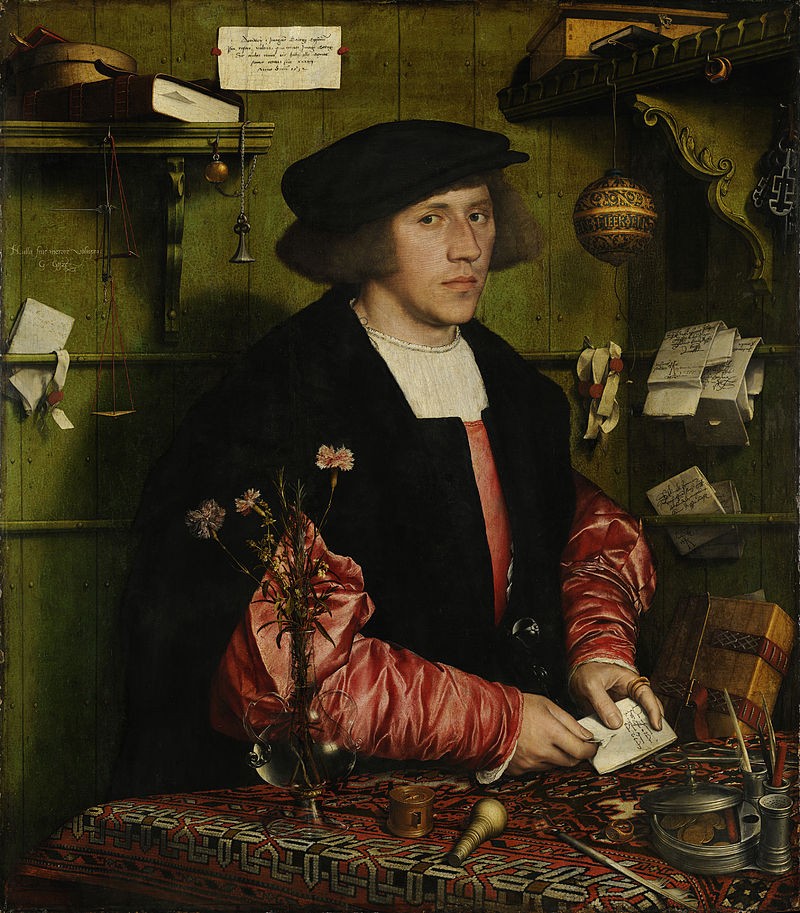
Georg Giese from Danzig, 34-year-old German merchant at the Steelyard, painted in London by Hans Holbein in 1532
Credit: Hans Holbein
Licence:


Walbrook Wharf is an operating freight wharf located in the City of London adjacent to Cannon Street station.
Licence:


Etching of All Hallows Staining tower, drawn in 1922
Credit: Public domain
Licence: CC BY 2.0


Southwark Cathedral
Credit: IG/aleks london diary
Licence:


"London Bridge from the Old Swan" by the Irish painter Hubert Pugh (1780) Shooting the tidal rapids at old London Bridge was dangerous; many passengers preferred to get off at the Old Swan, and walk. Immediately across the river in the painting is St Saviour’s Church, now Southwark Cathedral.
Credit: Hubert Pugh (Bank of England Museum)
Licence:


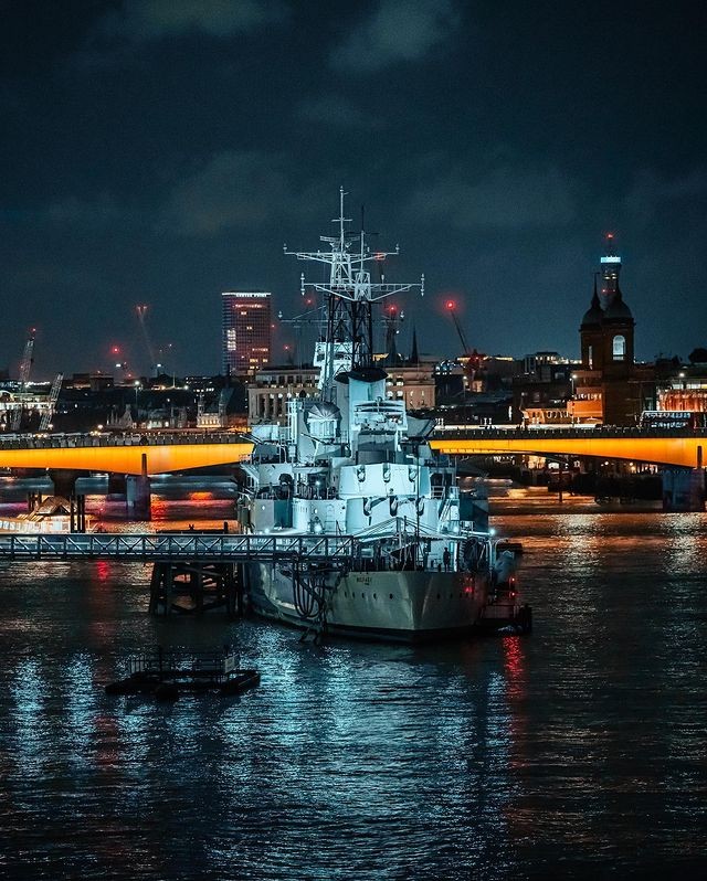
HMS Belfast (2022)
Credit: IG/city visual
Licence: CC BY 2.0


The George Inn (1889) On Borough High Street and once known as the George and Dragon, the pub is the only surviving galleried London coaching inn.
Credit: National Trust
Licence:


Optician built into the facade of St Ethelburga’s, Bishopsgate, c.1910
Credit: Bishopsgate Institute
Licence:


The Church of All Hallows Lombard Street as seen from Ball Alley in the 1820s. All Hallows was a rare City of London church not demolished due to the Great Fire or the Blitz but to falling attendances. Taken from ’The Churches of London’ by George Godwin (1839)
Credit: Robert William Billings and John Le Keux
Licence:


  Contact us · Copyright policy · Privacy policy