Lydford Road, W9
Road in/near West Kilburn .
| Lydford Road, W9 Road in/near West Kilburn . |
| HOME | · | ARTICLE | · | MAPS | · | STREETS | · | BLOG | · | CONTACT US |
| MAP YEAR: | 1750 | 1800 | 1810 | 1820 | 1830 | 1860 | 1900 | 1950 | 2024 | Show map without markers |
| Use the control in the top right of the map above to view this area on another historic map | ||||||||||
| Click here to explore another London street We now have 666 completed street histories and 46834 partial histories Find streets or residential blocks within the M25 by clicking STREETS |
| CONTRIBUTIONS TO THE LOCALITY |
  ANON Added: 20 Jul 2022 13:36 GMT | The Square & Ashmore park The Square and Ashmore park was the place to be 2000-2005. Those were the greatest times on the estate. everyday people were playing out. the park was full of kids just being kids and having fun, now everyone is grown up and only bump into eachother when heading to the shops or work. I miss the good days( Im 25yrs old as im writing this) Reply |
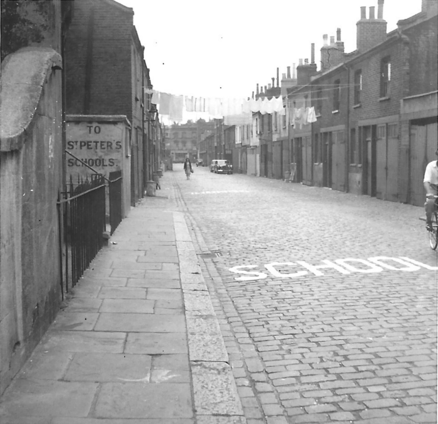
 Fumblina Added: 27 Mar 2021 11:13 GMT | St Jude’s Church, Lancefield Street Saint Jude’s was constructed in 1878, while the parish was assigned in 1879 from the parish of Saint John, Kensal Green (P87/JNE2). The parish was united with the parishes of Saint Luke (P87/LUK1) and Saint Simon (P87/SIM) in 1952. The church was used as a chapel of ease for a few years, but in 1959 it was closed and later demolished. The church is visible on the 1900 map for the street on the right hand side above the junction with Mozart Street. Source: SAINT JUDE, KENSAL GREEN: LANCEFIELD STREET, WESTMINSTER | Londo Reply |
 Fumblina Added: 27 Mar 2021 11:08 GMT | Wedding at St Jude’s Church On 9th November 1884 Charles Selby and Johanna Hanlon got married in St Jude’s Church on Lancefield Street. They lived together close by at 103 Lancefield Street. Charles was a Lather, so worked in construction. He was only 21 but was already a widower. Johanna is not shown as having a profession but this is common in the records and elsewhere she is shown as being an Ironer or a Laundress. It is possible that she worked at the large laundry shown at the top of Lancefield Road on the 1900 map. She was also 21. She was not literate as her signature on the record is a cross. The ceremony was carried out by William Hugh Wood and was witnessed by Charles H Hudson and Caroline Hudson. Source: https://www.ancestry.co.uk/imageviewer/collections/1623/images/31280_197456-00100?pId=6694792 Reply |
  Ron Shepherd Added: 18 Sep 2021 17:28 GMT | More Wisdom Norman Joseph Wisdom was born in St Mary’s Hospital, Paddington, West London. Reply |
Added: 14 Jan 2022 03:06 GMT | Goldbourne Gardens W 10 I lived in Goldbourne Gardens in the 50,s very happy big bomb site Reply |
| LATEST LONDON-WIDE CONTRIBUTIONS TO THE PROJECT |
 Tony Whipple Added: 16 Apr 2024 21:35 GMT | Frank Whipple Place, E14 Frank was my great-uncle, I’d often be ’babysat’ by Peggy while Nan and Dad went to the pub. Peggy was a marvel, so full of life. My Dad and Frank didn’t agree on most politics but everyone in the family is proud of him. A genuinely nice, knowledgable bloke. One of a kind. Reply |
 Theresa Penney Added: 16 Apr 2024 18:08 GMT | 1 Whites Row My 2 x great grandparents and his family lived here according to the 1841 census. They were Dutch Ashkenazi Jews born in Amsterdam at the beginning of the 19th century but all their children were born in Spitalfields. Reply |
Wendy Added: 22 Mar 2024 15:33 GMT | Polygon Buildings Following the demolition of the Polygon, and prior to the construction of Oakshott Court in 1974, 4 tenement type blocks of flats were built on the site at Clarendon Sq/Phoenix Rd called Polygon Buildings. These were primarily for people working for the Midland Railway and subsequently British Rail. My family lived for 5 years in Block C in the 1950s. It seems that very few photos exist of these buildings. Reply |
  Steve Added: 19 Mar 2024 08:42 GMT | Road construction and houses completed New Charleville Circus road layout shown on Stanford’s Library Map Of London And Its Suburbs 1879 with access via West Hill only. Plans showing street numbering were recorded in 1888 so we can concluded the houses in Charleville Circus were built by this date. Source: Charleville Circus, Sydenham, London Reply |
Steve Added: 19 Mar 2024 08:04 GMT | Charleville Circus, Sydenham: One Place Study (OPS) One Place Study’s (OPS) are a recent innovation to research and record historical facts/events/people focused on a single place �’ building, street, town etc. I have created an open access OPS of Charleville Circus on WikiTree that has over a million members across the globe working on a single family tree for everyone to enjoy, for free, forever. Source: Charleville Circus, Sydenham, London Reply |
Charles Added: 8 Mar 2024 20:45 GMT | My House I want to know who lived in my house in the 1860’s. Reply |
 NH Added: 7 Mar 2024 11:41 GMT | Telephone House Donald Hunter House, formerly Telephone House, was the BT Offices closed in 2000 Reply |
Paul Cox Added: 5 Mar 2024 22:18 GMT | War damage reinstatement plans of No’s 11 & 13 Aldine Street Whilst clearing my elderly Mothers house of general detritus, I’ve come across original plans (one on acetate) of No’s 11 & 13 Aldine Street. Might they be of interest or should I just dispose of them? There are 4 copies seemingly from the one single acetate example. Seems a shame to just junk them as the level of detail is exquisite. No worries if of no interest, but thought I’d put it out there. Reply |
| LOCAL PHOTOS |