West Cross Route, W11

Road in/near Notting Hill, existing between the 1970s and now.

 HOME  ·  ARTICLE  ·  MAPS  ·  STREETS  ·  BLOG  ·  CONTACT US 
(51.50797 -0.21852, 51.507 -0.218) 
MAP YEAR:175018001810182018301860190019502024Show map without markers
Use the control in the top right of the map above to view this area on another historic map
 
Road · * · W11 ·
July
12
2017
The West Cross Route is a 1.21 km-long dual carriageway running north-south between the northern elevated roundabout junction with the western end of Westway (A40) and the southern Holland Park Roundabout.

The WCR was formerly the M41 motorway. Its status was downgraded to an A-road in 2000 when responsibility for trunk roads in Greater London was transferred from the Highways Agency to the Greater London Authority.

The WCR was originally the designation for the western section of Ringway 1, the innermost circuit of the London Ringways network, a complex and comprehensive plan for a network of high-speed roads circling central London designed to manage and control the flow of traffic within the capital.

The WCR and the other roads planned in the 1960s for central London had developed from early schemes prior to the Second World War through Sir Patrick Abercrombie’s County of London Plan, 1943 and Greater London Plan, 1944 to a 1960s Greater London Council (GLC) scheme that would have involved the construction of many miles of motorway-standard roads across the city and demolition on a massive scale. Due to the huge construction costs and widespread public opposition, most of the scheme was cancelled in 1973 and the WCR, Westway and the East Cross Route in east London were the only significant parts to be built.

At the northern end, had the road been built in full, the entry and exit ramps to and from the elevated roundabout with the Westway would have been slip roads. The main route would have continued north beneath the roundabout into North Kensington and on to the junction with the North Cross Route at Harlesden. The alignment of the slip roads leaves a wide space between for the unbuilt carriageway. On the north side of the roundabout, two short stubs indicate the starting point of the slip roads that would have been provided for traffic joining or leaving the northern section of the WCR.

South of the Holland Park roundabout, which the WCR would have passed above on a flyover, the route would have continued along the alignment of the West London Line passing over Kensington (Olympia) station to a westbound-only interchange with the A4 at Talgarth Road. It would then have been elevated over Earls Court Exhibition Centre, skirted the western edge of Brompton Cemetery, and passed by Stamford Bridge stadium before an eastbound-only interchange along Lots Road to meet Cheyne Walk. Next the WCR would have crossed the River Thames on a new bridge and entered Battersea where it would have had a junction with the South Cross Route.

Although the road no longer has motorway status, pedal cycles are prohibited by a sign at Holland Park roundabout.

Approximately halfway along the road’s length a new junction was built in the 2010s to serve the Westfield London shopping development.


Licence: Creative Commons Attribution-ShareAlike Licence


Click here to explore another London street
We now have 666 completed street histories and 46834 partial histories
Find streets or residential blocks within the M25 by clicking STREETS


CONTRIBUTIONS TO THE LOCALITY

Comment
Jonathan Penner   
Added: 11 Sep 2021 16:03 GMT   

Pennard Road, W12
My wife and I, young Canadians, lodged at 65 (?) Pennard Road with a fellow named Clive and his girlfriend, Melanie, for about 6 months in 1985. We loved the area and found it extremely convenient.

Reply
Comment
Paul Cox   
Added: 5 Mar 2024 22:18 GMT   

War damage reinstatement plans of No’s 11 & 13 Aldine Street
Whilst clearing my elderly Mothers house of general detritus, I’ve come across original plans (one on acetate) of No’s 11 & 13 Aldine Street. Might they be of interest or should I just dispose of them? There are 4 copies seemingly from the one single acetate example. Seems a shame to just junk them as the level of detail is exquisite. No worries if of no interest, but thought I’d put it out there.

Reply
Reply
   
Added: 27 Mar 2024 15:31 GMT   

Aldine Street, W12
If you still have these drawings, you might want to contact The London Metropolitan Archives as they may well want to have them.

Reply

LATEST LONDON-WIDE CONTRIBUTIONS TO THE PROJECT

Comment
Tony Whipple   
Added: 16 Apr 2024 21:35 GMT   

Frank Whipple Place, E14
Frank was my great-uncle, I’d often be ’babysat’ by Peggy while Nan and Dad went to the pub. Peggy was a marvel, so full of life. My Dad and Frank didn’t agree on most politics but everyone in the family is proud of him. A genuinely nice, knowledgable bloke. One of a kind.

Reply
Comment
Theresa Penney   
Added: 16 Apr 2024 18:08 GMT   

1 Whites Row
My 2 x great grandparents and his family lived here according to the 1841 census. They were Dutch Ashkenazi Jews born in Amsterdam at the beginning of the 19th century but all their children were born in Spitalfields.

Reply
Comment
Wendy    
Added: 22 Mar 2024 15:33 GMT   

Polygon Buildings
Following the demolition of the Polygon, and prior to the construction of Oakshott Court in 1974, 4 tenement type blocks of flats were built on the site at Clarendon Sq/Phoenix Rd called Polygon Buildings. These were primarily for people working for the Midland Railway and subsequently British Rail. My family lived for 5 years in Block C in the 1950s. It seems that very few photos exist of these buildings.

Reply

Steve   
Added: 19 Mar 2024 08:42 GMT   

Road construction and houses completed
New Charleville Circus road layout shown on Stanford’s Library Map Of London And Its Suburbs 1879 with access via West Hill only.

Plans showing street numbering were recorded in 1888 so we can concluded the houses in Charleville Circus were built by this date.

Source: Charleville Circus, Sydenham, London

Reply
Comment
Steve   
Added: 19 Mar 2024 08:04 GMT   

Charleville Circus, Sydenham: One Place Study (OPS)
One Place Study’s (OPS) are a recent innovation to research and record historical facts/events/people focused on a single place �’ building, street, town etc.

I have created an open access OPS of Charleville Circus on WikiTree that has over a million members across the globe working on a single family tree for everyone to enjoy, for free, forever.

Source: Charleville Circus, Sydenham, London

Reply
Comment
Charles   
Added: 8 Mar 2024 20:45 GMT   

My House
I want to know who lived in my house in the 1860’s.

Reply

NH   
Added: 7 Mar 2024 11:41 GMT   

Telephone House
Donald Hunter House, formerly Telephone House, was the BT Offices closed in 2000

Reply
Comment
Paul Cox   
Added: 5 Mar 2024 22:18 GMT   

War damage reinstatement plans of No’s 11 & 13 Aldine Street
Whilst clearing my elderly Mothers house of general detritus, I’ve come across original plans (one on acetate) of No’s 11 & 13 Aldine Street. Might they be of interest or should I just dispose of them? There are 4 copies seemingly from the one single acetate example. Seems a shame to just junk them as the level of detail is exquisite. No worries if of no interest, but thought I’d put it out there.

Reply


LOCAL PHOTOS
Click here to see map view of nearby Creative Commons images
Click here to see Creative Commons images near to this postcode
Click here to see Creative Commons images tagged with this road (if applicable)
Kensington Park Hotel
TUM image id: 1453375720
Licence: CC BY 2.0
Addison Place
Credit: Google Maps
TUM image id: 1457274476
Licence: CC BY 2.0

In the neighbourhood...

Click an image below for a better view...
The St Agnes soup kitchen was situated on the corner of Bangor Street, W11 that this photo was taken from. Bangor Street disappeared from the streetscene of Notting Dale after the Second World War.
Credit: Bishopsgate Institute
Licence:


HM Queen Elizabeth, Queen Mother, with Lady Petrie, opening Henry Dickens Court, W11 (1953) The Queen Mother is greeted by large crowds and is accompanied by Lady Petrie, Mayor of Kensington. Henry Dickens Court was built by the Council on a bomb site as part of the borough’s post war redevelopment plan. It was named after Henry Dickens, grandson of Charles Dickens, an Alderman on the Council and an active advocate of municipal housing.
Credit: Kensington Libraries
Licence:


Corner of Bangor Street and Sirdar Road, W11 (1911) This became the Dolphin Pub. The location was demolished to make way for the Henry Dickens Estate.
Credit: London City Mission magazine
Licence:


Local resident Trevor who grew tomatoes in compost made from Frestonian residents’ waste. Frestonia was the name adopted by the residents of Freston Road, London W11, when they attempted to secede from the United Kingdom in 1977 to form the Free and Independent Republic of Frestonia. Many residents eventually set up a housing co-op in negotiation with Notting Hill Housing Trust, and included artists, musicians, writers, actors and activists. Actor David Rappaport was the Frestonia Foreign Minister while playwright Heathcote Williams served as Ambassador to the United Kingdom.
Licence:


Martin Street, looking west (1960s) Martin Street disappeared from the map as the Latimer Road area was redeveloped in the late 1960s
Licence:


Guy Fawkes and friends in Addison Avenue, W11 (around 1960)
Licence:


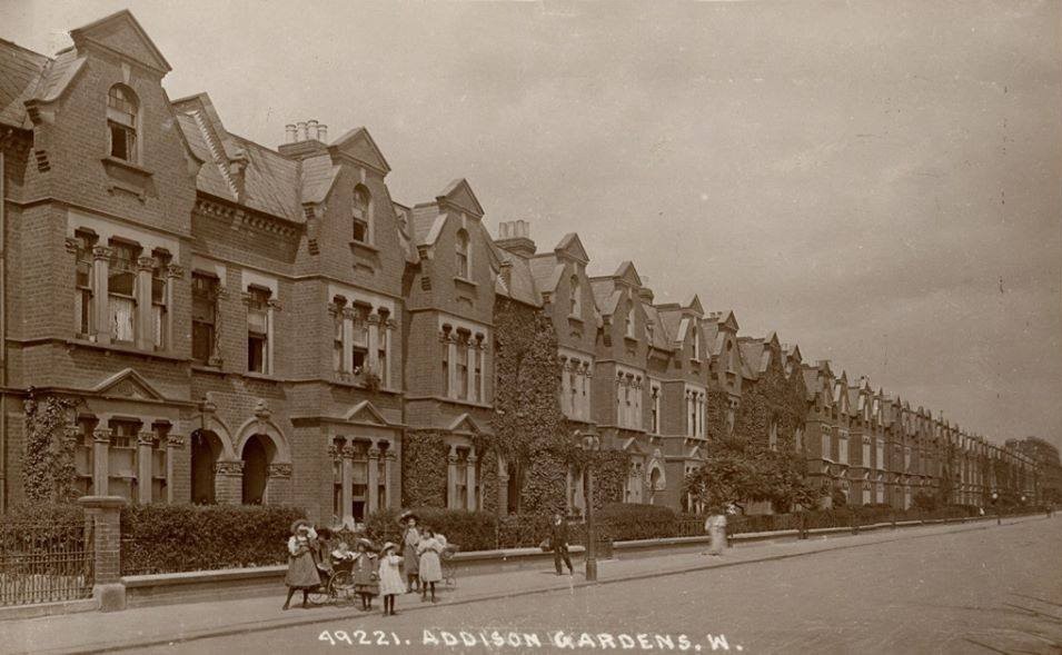
Addison Gardens, W14
Old London postcard
Licence:


Addison Place
Credit: Google Maps
Licence: CC BY 2.0


Ansleigh Place, W11
Licence: CC BY 2.0


St Ann’s Villas, W11 looking south from St Ann’s Road towards Royal Crescent. The developer was Charles Stewart, a wealthy barrister who had served as an MP in the early 1830s. Between 1840 and 1846 he took building leases with his principal ventures being in Royal Crescent (where he had 43 houses) and St Ann’s Villas (34 houses). The Stewart Arms public house on Norland Road commemorates his name.
Credit: GoArt/The Underground Map
Licence:


  Contact us · Copyright policy · Privacy policy