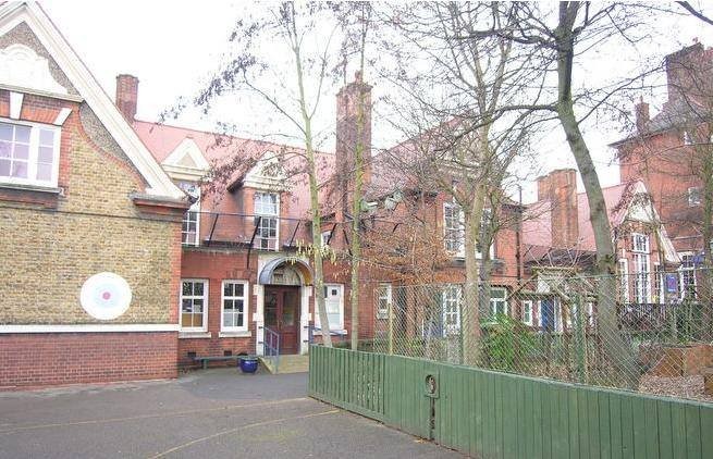
Pember Road, NW10
Road in/near Kensal Green, existing between the 1870s and now.
| Pember Road, NW10 Road in/near Kensal Green, existing between the 1870s and now. |
| HOME | · | ARTICLE | · | MAPS | · | STREETS | · | BLOG | · | CONTACT US |
| MAP YEAR: | 1750 | 1800 | 1810 | 1820 | 1830 | 1860 | 1900 | 1950 | 2024 | Show map without markers |
| TIP: To see an article about a particular location, click one of the markers on the map | ||||||||||
| Click here to explore another London street We now have 666 completed street histories and 46834 partial histories Find streets or residential blocks within the M25 by clicking STREETS |
| CONTRIBUTIONS TO THE LOCALITY |
  Dave Fahey Added: 6 Jan 2021 02:40 GMT | Bombing of the Jack O Newberry My maternal grandfather, Archie Greatorex, was the licensee of the Earl of Warwick during the Second World War. My late mother Vera often told the story of the bombing of the Jack. The morning after the pub was bombed, the landlord’s son appeared at the Warwick with the pub’s till on an old pram; he asked my grandfather to pay the money into the bank for him. The poor soul was obviously in shock. The previous night, his parents had taken their baby down to the pub cellar to shelter from the air raids. The son, my mother never knew his name, opted to stay in his bedroom at the top of the building. He was the only survivor. I often wondered what became of him. Reply |
  Scott Hatton Added: 11 Sep 2020 15:38 GMT | 6 East Row (1960 - 1960) We lived at 6 East Row just before it was demolished. Reply |
  danny currie Added: 30 Nov 2022 18:39 GMT | dads yard ron currie had a car breaking yard in millers yard back in the 60s good old days Reply |
 donna Added: 25 Jan 2021 13:25 GMT | Ladbroke Dwellings Three generations of my family lived along this row of dwellings, ’Ladbroke Dwellings’. All the men who lived there worked at the Gasworks. Among the shops you mention was Wilson’s sweet shop run by Maggie and her sister, and Johns grocery store. I believe there was also a photograph studio there too. Reply |
  Sean Farrell Added: 13 Feb 2024 10:09 GMT | Jack of Newbury His name was Thomas Mathews. He was not the son, but son-in-law (or possibly brother-in-law) to Catherine Bond, wife of the licensee, William. He was a taxi driver before and after the war and eventually took on a pub in Bedfordshire in the 1960’s. He died in 1984. It was information from his nephew that I heard about his escape from the rubble of the pub. Reply |
| LATEST LONDON-WIDE CONTRIBUTIONS TO THE PROJECT |
Wendy Added: 22 Mar 2024 15:33 GMT | Polygon Buildings Following the demolition of the Polygon, and prior to the construction of Oakshott Court in 1974, 4 tenement type blocks of flats were built on the site at Clarendon Sq/Phoenix Rd called Polygon Buildings. These were primarily for people working for the Midland Railway and subsequently British Rail. My family lived for 5 years in Block C in the 1950s. It seems that very few photos exist of these buildings. Reply |
  Steve Added: 19 Mar 2024 08:42 GMT | Road construction and houses completed New Charleville Circus road layout shown on Stanford’s Library Map Of London And Its Suburbs 1879 with access via West Hill only. Plans showing street numbering were recorded in 1888 so we can concluded the houses in Charleville Circus were built by this date. Source: Charleville Circus, Sydenham, London Reply |
Steve Added: 19 Mar 2024 08:04 GMT | Charleville Circus, Sydenham: One Place Study (OPS) One Place Study’s (OPS) are a recent innovation to research and record historical facts/events/people focused on a single place �’ building, street, town etc. I have created an open access OPS of Charleville Circus on WikiTree that has over a million members across the globe working on a single family tree for everyone to enjoy, for free, forever. Source: Charleville Circus, Sydenham, London Reply |
Charles Added: 8 Mar 2024 20:45 GMT | My House I want to know who lived in my house in the 1860’s. Reply |
 NH Added: 7 Mar 2024 11:41 GMT | Telephone House Donald Hunter House, formerly Telephone House, was the BT Offices closed in 2000 Reply |
Paul Cox Added: 5 Mar 2024 22:18 GMT | War damage reinstatement plans of No’s 11 & 13 Aldine Street Whilst clearing my elderly Mothers house of general detritus, I’ve come across original plans (one on acetate) of No’s 11 & 13 Aldine Street. Might they be of interest or should I just dispose of them? There are 4 copies seemingly from the one single acetate example. Seems a shame to just junk them as the level of detail is exquisite. No worries if of no interest, but thought I’d put it out there. Reply |
 Diana Added: 28 Feb 2024 13:52 GMT | New Inn Yard, E1 My great grandparents x 6 lived in New Inn Yard. On this date, their son was baptised in nearby St Leonard’s Church, Shoreditch Source: BDM London, Cripplegate and Shoreditch registers written by church clerk. Reply |
Vic Stanley Added: 24 Feb 2024 17:38 GMT | Postcose The postcode is SE15, NOT SE1 Reply |
| LOCAL PHOTOS |