Macfarlane Place, W12
| Macfarlane Place, W12 |
| HOME | · | ARTICLE | · | MAPS | · | STREETS | · | BLOG | · | CONTACT US |
| MAP YEAR: | 1750 | 1800 | 1810 | 1820 | 1830 | 1860 | 1900 | 1950 | 2024 | Show map without markers |
| Use the control in the top right of the map above to view this area on another historic map | ||||||||||
| Click here to explore another London street We now have 666 completed street histories and 46834 partial histories Find streets or residential blocks within the M25 by clicking STREETS |
| CONTRIBUTIONS TO THE LOCALITY |
  Jonathan Penner Added: 11 Sep 2021 16:03 GMT | Pennard Road, W12 My wife and I, young Canadians, lodged at 65 (?) Pennard Road with a fellow named Clive and his girlfriend, Melanie, for about 6 months in 1985. We loved the area and found it extremely convenient. Reply |
 Paul Cox Added: 5 Mar 2024 22:18 GMT | War damage reinstatement plans of No’s 11 & 13 Aldine Street Whilst clearing my elderly Mothers house of general detritus, I’ve come across original plans (one on acetate) of No’s 11 & 13 Aldine Street. Might they be of interest or should I just dispose of them? There are 4 copies seemingly from the one single acetate example. Seems a shame to just junk them as the level of detail is exquisite. No worries if of no interest, but thought I’d put it out there. Reply |
 Added: 27 Mar 2024 15:31 GMT | Aldine Street, W12 If you still have these drawings, you might want to contact The London Metropolitan Archives as they may well want to have them. Reply |
| LATEST LONDON-WIDE CONTRIBUTIONS TO THE PROJECT |
 Theresa Penney Added: 16 Apr 2024 18:08 GMT | 1 Whites Row My 2 x great grandparents and his family lived here according to the 1841 census. They were Dutch Ashkenazi Jews born in Amsterdam at the beginning of the 19th century but all their children were born in Spitalfields. Reply |
Wendy Added: 22 Mar 2024 15:33 GMT | Polygon Buildings Following the demolition of the Polygon, and prior to the construction of Oakshott Court in 1974, 4 tenement type blocks of flats were built on the site at Clarendon Sq/Phoenix Rd called Polygon Buildings. These were primarily for people working for the Midland Railway and subsequently British Rail. My family lived for 5 years in Block C in the 1950s. It seems that very few photos exist of these buildings. Reply |
  Steve Added: 19 Mar 2024 08:42 GMT | Road construction and houses completed New Charleville Circus road layout shown on Stanford’s Library Map Of London And Its Suburbs 1879 with access via West Hill only. Plans showing street numbering were recorded in 1888 so we can concluded the houses in Charleville Circus were built by this date. Source: Charleville Circus, Sydenham, London Reply |
Steve Added: 19 Mar 2024 08:04 GMT | Charleville Circus, Sydenham: One Place Study (OPS) One Place Study’s (OPS) are a recent innovation to research and record historical facts/events/people focused on a single place �’ building, street, town etc. I have created an open access OPS of Charleville Circus on WikiTree that has over a million members across the globe working on a single family tree for everyone to enjoy, for free, forever. Source: Charleville Circus, Sydenham, London Reply |
Charles Added: 8 Mar 2024 20:45 GMT | My House I want to know who lived in my house in the 1860’s. Reply |
 NH Added: 7 Mar 2024 11:41 GMT | Telephone House Donald Hunter House, formerly Telephone House, was the BT Offices closed in 2000 Reply |
Paul Cox Added: 5 Mar 2024 22:18 GMT | War damage reinstatement plans of No’s 11 & 13 Aldine Street Whilst clearing my elderly Mothers house of general detritus, I’ve come across original plans (one on acetate) of No’s 11 & 13 Aldine Street. Might they be of interest or should I just dispose of them? There are 4 copies seemingly from the one single acetate example. Seems a shame to just junk them as the level of detail is exquisite. No worries if of no interest, but thought I’d put it out there. Reply |
 Diana Added: 28 Feb 2024 13:52 GMT | New Inn Yard, E1 My great grandparents x 6 lived in New Inn Yard. On this date, their son was baptised in nearby St Leonard’s Church, Shoreditch Source: BDM London, Cripplegate and Shoreditch registers written by church clerk. Reply |
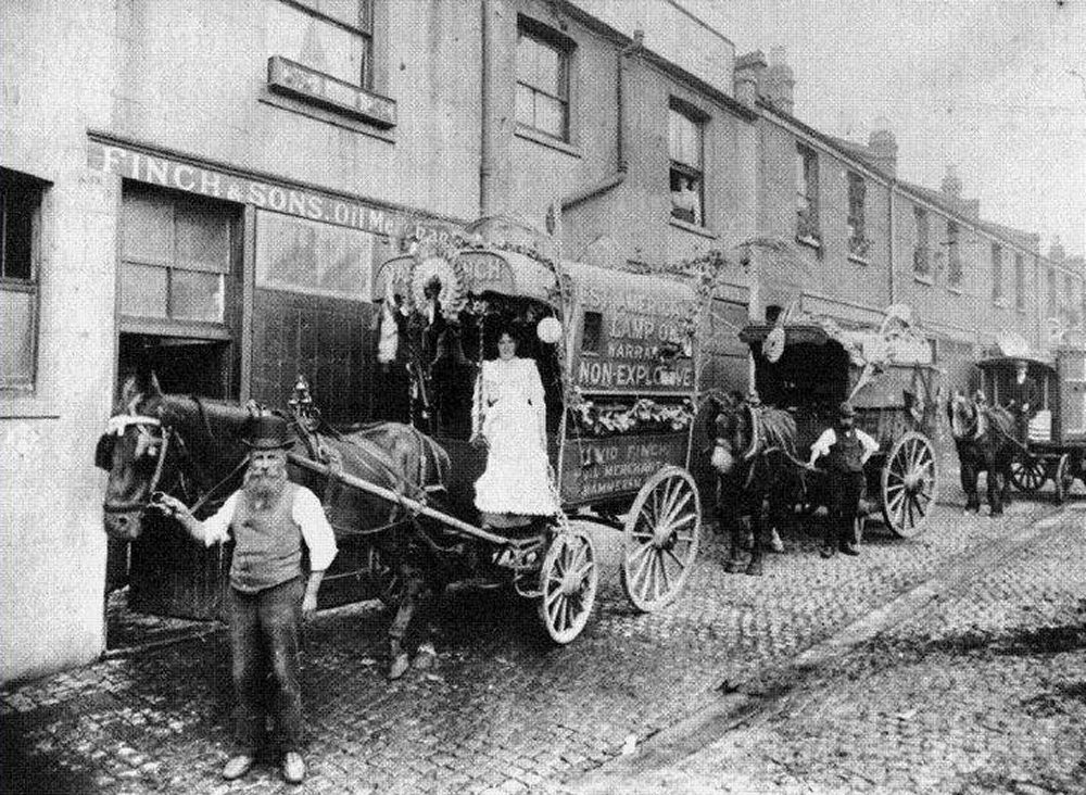
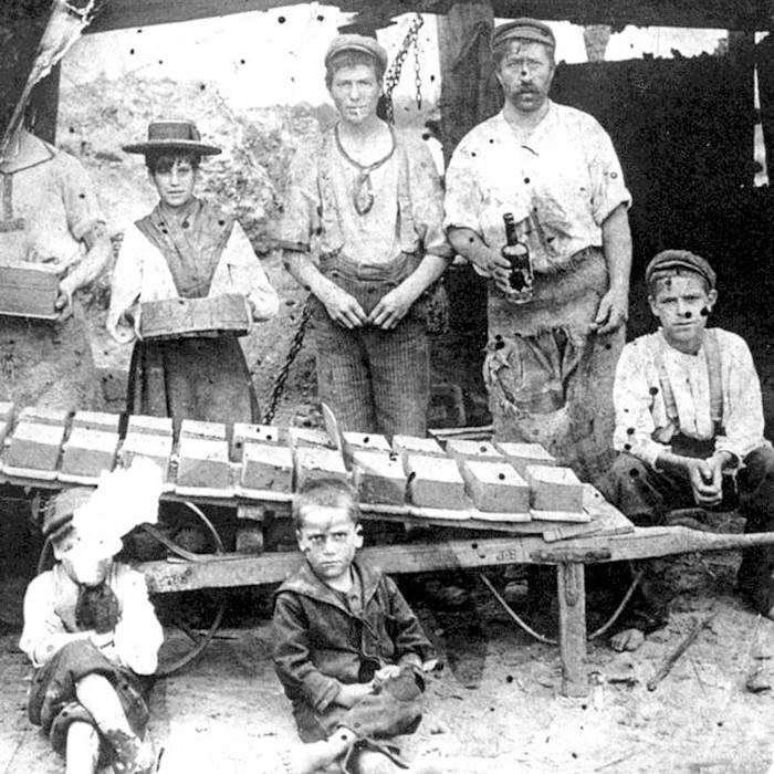
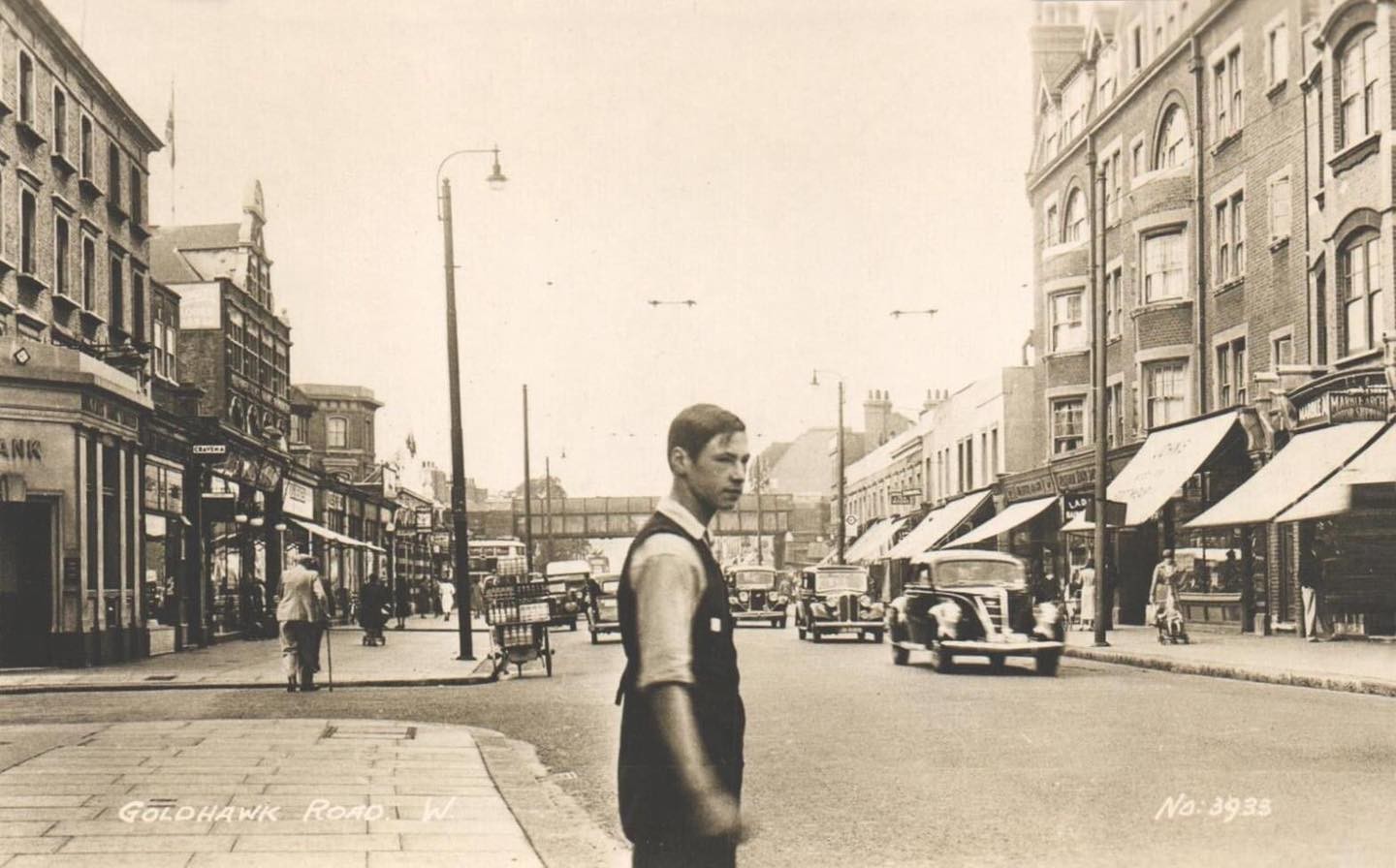
| LOCAL PHOTOS |