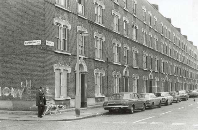
Amelia Street, SE11


 HOME  ·  ARTICLE  ·  MAPS  ·  STREETS  ·  BLOG  ·  CONTACT US 
(51.48985 -0.09798, 51.489 -0.097) 


Amelia Street, SE11

This originally consisted of late 19th century tenement blocks built by James Pullen between 1886 and 1901.

During the 1980s the buildings between Manor Place and the south side of Amelia Street were demolished. The demolition of the rest of the Pullens Estate was prevented when squatters, intent on preserving the remainder of an individual late Victorian estate, occupied some of the blocks.

The south side of Amelia Street is now an open space - Pullens Gardens - created following the demolition of a tenement block.


Attribution: Ideal Homes

Licence: Not known


GO TO LOCATION PAGE
View page which features this image


w:en:Creative Commons
attribution share alike
Unless otherwise given an attribution, images and text on this website are licensed under the Creative Commons Attribution-Share Alike 2.0 Generic licence.
If given an attribution or citation, any reuse of material must credit the original source under their terms.
If there is no attribution or copyright, you are free:
  • to share - to copy, distribute and transmit the work
  • to remix - to adapt the work
Under the following conditions:
  • attribution - You must attribute the work in the manner specified by the author or licensor (but not in any way that suggests that they endorse you or your use of the work).
  • share alike - If you alter, transform, or build upon this work, you may distribute the resulting work only under the same or similar license to this one.

1900 and 1950 mapping is reproduced with the permission of the National Library of Scotland under the terms of the Creative Commons Attribution (CC-BY) licence.