Cricklewood Broadway (1933)

Image dated 1933.

 HOME  ·  ARTICLE  ·  MAPS  ·  STREETS  ·  BLOG  ·  CONTACT US 
(51.56142 -0.2206, 51.561 -0.22) 
MAP YEAR:175018001810182018301860190019502023Show map without markers
ZOOM:14 15 16 17 14 15 16 17 14 15 16 17 14 15 16 17 14 15 16 17 14 15 16 17 14 15 16 17 18 14 15 16 17 14 15 16 17 18
TIP: To create your own sharable map, right click on the map
Photo taken in a northwesterly direction · Cricklewood · NW2 ·
JUNE
11
2020
Smiths of Cricklewood were notable clockmakers.

The photo can be accurately dated due to the performance of "The One Girl" listed on the poster.


Licence: Creative Commons Attribution-ShareAlike Licence


Click here to explore another London street
We now have 642 completed street histories and 46858 partial histories
Find streets or residential blocks within the M25 by clicking STREETS


CONTRIBUTIONS TO THE LOCALITY


Kevin Pont   
Added: 30 Aug 2023 09:47 GMT   

The connection with Bletchley Park
The code-breaking computer used at Bletchley Park was built in Dollis Hill.

Reply

Brian Lynch   
Added: 10 Apr 2022 13:38 GMT   

Staples Mattress Factory
An architect’s design of the Staples Mattress Factory
An image found on the website of Dalzell’s Beds, in Armagh Northern Ireland.

Reply

LATEST LONDON-WIDE CONTRIBUTIONS TO THE PROJECT


Sue   
Added: 24 Sep 2023 19:09 GMT   

Meyrick Rd
My family - Roe - lived in poverty at 158 Meyrick Rd in the 1920s, moving to 18 Lavender Terrace in 1935. They also lived in York Rd at one point. Alf, Nell (Ellen), plus children John, Ellen (Did), Gladys, Joyce & various lodgers. Alf worked for the railway (LMS).

Reply
Born here
Michael   
Added: 20 Sep 2023 21:10 GMT   

Momentous Birth!
I was born in the upstairs front room of 28 Tyrrell Avenue in August 1938. I was a breach birth and quite heavy ( poor Mum!). My parents moved to that end of terrace house from another rental in St Mary Cray where my three year older brother had been born in 1935. The estate was quite new in 1938 and all the properties were rented. My Father was a Postman. I grew up at no 28 all through WWII and later went to Little Dansington School

Reply

Mike Levy   
Added: 19 Sep 2023 18:10 GMT   

Bombing of Arbour Square in the Blitz
On the night of September 7, 1940. Hyman Lubosky (age 35), his wife Fay (or Fanny)(age 32) and their son Martin (age 17 months) died at 11 Arbour Square. They are buried together in Rainham Jewish Cemetery. Their grave stones read: "Killed by enemy action"

Reply

Lady Townshend   
Added: 8 Sep 2023 16:02 GMT   

Tenant at Westbourne (1807 - 1811)
I think that the 3rd Marquess Townshend - at that time Lord Chartley - was a tenant living either at Westbourne Manor or at Bridge House. He undertook considerable building work there as well as creating gardens. I am trying to trace which house it was. Any ideas gratefully received

Reply

Alex Britton   
Added: 30 Aug 2023 10:43 GMT   

Late opening
The tracks through Roding Valley were opened on 1 May 1903 by the Great Eastern Railway (GER) on its Woodford to Ilford line (the Fairlop Loop).

But the station was not opened until 3 February 1936 by the London and North Eastern Railway (LNER, successor to the GER).

Source: Roding Valley tube station - Wikipedia

Reply
Comment
Kevin Pont   
Added: 30 Aug 2023 09:52 GMT   

Shhh....
Roding Valley is the quietest tube station, each year transporting the same number of passengers as Waterloo does in one day.

Reply

Kevin Pont   
Added: 30 Aug 2023 09:47 GMT   

The connection with Bletchley Park
The code-breaking computer used at Bletchley Park was built in Dollis Hill.

Reply
Comment
Kevin Pont   
Added: 29 Aug 2023 15:25 GMT   

The deepest station
At 58m below ground, Hampstead is as deep as Nelson’s Column is tall.

Source: Hampstead tube station - Wikipedia

Reply


NEARBY LOCATIONS OF NOTE
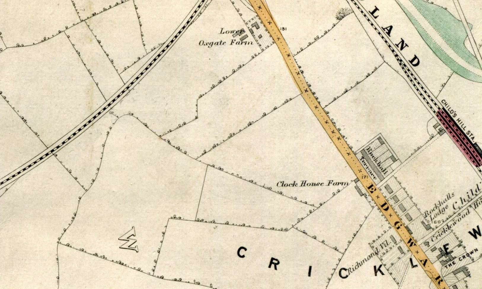
Clockhouse Farm, NW2 Clockhouse Farm was also known as Clock Farm.
Cricklewood Broadway (1933) Smiths of Cricklewood were notable clockmakers.

NEARBY STREETS
Alan Coren Close, NW2 Alan Coren Close is named for an important contributor to Cricklewood culture.
Allotment Way, NW2 Allotment Way is a road in the NW2 postcode area
Briar Road, NW2 Briar Road is a road in the NW2 postcode area
Broadfield Close, NW2 Broadfield Close is a road in the NW2 postcode area
Broadway Retail Park, NW2 Broadway Retail Park is a retail zone in Cricklewood.
Burlington Parade, NW2 Burlington Parade lies along the Edgware Road.
Campion Terrace, NW2 Campion Terrace is a location in London.
Caney Mews, NW2 Caney Mews is a road in the NW2 postcode area
Cedar Road, NW2 Cedar Road dates from 1893.
Chiltern Gardens, NW2 Chiltern Gardens is a road in the NW2 postcode area
Chipstead Gardens, NW2 Chipstead Gardens is a road in the NW2 postcode area
Claremont Road, NW2 Claremont Road seems to date from after 1860.
Compton Close, NW2 Compton Close is a street in Golders Green.
Copper Mead Close, NW2 Copper Mead Close is a location in London.
Coppermead Close, NW2 Coppermead Close is a road in the NW2 postcode area
Dairyman Close, NW2 Dairyman Close is a street in Cricklewood.
Depot Approach, NW2 Depot Approach is a street in Cricklewood.
Draycott Close, NW2 Draycott Close is a street in Cricklewood.
Gladstone Parade, NW2 Gladstone Parade is a street in Cricklewood.
Gladstone Park Gardens, NW2 Gladstone Park Gardens is a street in Cricklewood.
Gratton Terrace, NW2 Gratton Terrace is a road in the NW2 postcode area
Handley Grove, NW2 Handley Grove is a street in Cricklewood.
Hassop Road, NW2 Hassop Road is a street in Cricklewood.
Hudson Way, NW2 Hudson Way is a road in the NW2 postcode area
Kara Way, NW2 Kara Way is a street in Cricklewood.
Langton Road, NW2 Langton Road is a road in the NW2 postcode area
Larch Road, NW2 Larch Road was developed by George Furness as part of what he called Cricklewood Park
Longley Way, NW2 Longley Way is a road in the NW2 postcode area
Mascotts Close, NW2 Mascotts Close is a road in the NW2 postcode area
Midland Terrace, NW2 Midland Terrace is a street in Cricklewood.
Mora Road, NW2 Mora Road is a street in Cricklewood.
Mount Road, NW2 Mount Road is a road in the NW2 postcode area
Needham Terrace, NW2 Needham Terrace was built as part of the ’Railway Village’.
New Row, NW2 New Row is a location in London.
Newton Road, NW2 Newton Road is a road in the NW2 postcode area
Oxgate Gardens, NW2 Oxgate Gardens is a street in Cricklewood.
Oxleys Road, NW2 Oxleys Road is a road in the NW2 postcode area
Pine Road, NW2 Pine Road continued a tradition of local roads named after trees.
Pinemartin Close, NW2 Pinemartin Close is a street in Cricklewood.
Rockhall Terrace, NW2 Rockhall Terrace, large houses on Edgware Road, dated from the 1850s.
Rockhall Way, NW2 Rockhall Way is a road in the NW2 postcode area
Roman Road, NW2 Roman Road is a street in Cricklewood.
Romney Row, NW2 Romney Row is a location in London.
Rusper Close, NW2 Rusper Close is a road in the NW2 postcode area
Sancroft Close, NW2 Sancroft Close is a road in the NW2 postcode area
Sandifer Drive, NW2 Sandifer Drive is a road in the NW2 postcode area
Shannon Close, NW11 Shannon Close is a street in Cricklewood.
Shobroke Close, NW2 Shobroke Close is a road in the NW2 postcode area
St Michaels Road, NW2 St Michaels Road is a street in Cricklewood.
Stoll Close, NW2 Stoll Close is a road in the NW2 postcode area
Temple Road, NW2 Earl Temple built Temple Road by 1906.
Topp Walk, NW2 Topp Walk lies near to Oxgate Gardens.
Water Board Cottage, NW2 Water Board Cottage is a location in London.
Wilkinson Close, NW2 Wilkinson Close is a location in London.
Woodvale Way, NW11 Woodvale Way is a road in the NW11 postcode area
Worley Court, NW11 Worley Court is a street in Cricklewood.
Wotton Road, NW2 Wotton Road is a street in Cricklewood.

NEARBY PUBS


Click here to explore another London street
We now have 630 completed street histories and 46870 partial histories


Cricklewood

Cricklewood is a district whose northeastern part is in the London Borough of Barnet, and the southwestern part is the London Borough of Brent and the southeastern part is in London Borough of Camden.

There was a small settlement at the junction of Cricklewood Lane and the Edgware Road by 1294, which by 1321 was being called Cricklewood. By the 1750s the Crown (rebuilt in 1889), was providing for coach travellers and by the 1800s it had a handful of cottages and Cricklewood House as neighbours, and was known for its pleasure gardens. By the 1860s there were a number of substantial villas along the Edgware Road starting with Rockhall Lodge and culminating in Rockhall Terrace.

Childs Hill Station, later Cricklewood, opened in 1868, but Cricklewood only fully became an industrial and suburban district in the 1930s. In the summer of 1881 the Midland Railway Company moved its locomotive works from Kentish Town to the new Brent Sidings, and in October of the same year it was announced that new accommodation for its workers would be built, later the Railway Terraces. Mr H Finch laid out a handful of roads directly behind the Crown Inn, (including Yew, Ash, and Elm, Grove) in 1880. The station became the terminus for the Midland Railways suburban services by 1884. The census of 1881 showed that the population had grown enough for a new church, and St Peter's replaced a tin chapel in 1891, (closed 1983 subsequent to rebuilding in the 1970s). The London General Omnibus Company terminated services to Regents Street at the Crown from 1883, opening a bus depot in 1899.

By the 1890s houses and shops had been built along part of Cricklewood Lane. . Cricklewood Broadway had become retail area by 1900 replacing the Victorian villas. The Queens Hall Cinema, later the Gaumont, replaced Rock Hall House, and was itself demolished in 1960. Thorverton road, was laid out in 1907, along with Caddington, and Dersingham Road, the year of the opening of Golders Green underground station. With the introduction of trams in 1904 and the motorisation of bus services by 1911, a number of important industries were established. The first of these was the Phoenix Telephone Co. in 1911 (later moved to the Hyde), quickly followed by Handley Page Ltd, aircraft manufacturers, from 1912 until 1917, at 110 Cricklewood Lane.

Cricklewood also became the home for the first Smith Crisps factory replacing the omnibus depot at Crown Yard. Having moved into new premises in Cricklewood Lane the yard was taken over by Clang electrical goods Ltd. From 1929 to 1933 the area was finally built over.

Cowhouse Farm, latterly Dickers Farm and finally Avenue Farm, was closed in 1932. From 1908 to 1935, Westcroft Farm was owned by the Home of Rest for Horses, at its peak it could house 250 horses. The Metropolitan Borough of Hampstead opened the Westcroft Estate in 1935. From the 1960s industry in the local area went into decline, and all the above-mentioned industries have left.


LOCAL PHOTOS
Click here to see map view of nearby Creative Commons images
Click here to see Creative Commons images near to this postcode

In the neighbourhood...

Click an image below for a better view...
Cricklewood Broadway (1957) Absolutely nothing so special about this photo - Sainsbury’s, Boots, Woolworth’s in a line - but just a remark that sometime in the 1970s, shopfronts changed their look from the formal and staid postwar incarnation to something a lot more “tatty” with bright colours and a lack of a thought-out arrangement of the whole look and feel of a high street.
Licence:


A line of three new LGOC B-type buses (route 1) stand ready for service, with their crews, at Cricklewood bus garage (1911) The new B-type bus was the world’s first mass-produced motorised bus, introduced in 1910 by Frank Searle. A bus inspector stands at the right foreground.
Credit: London Transport Museum
Licence: CC BY 2.0


Rockhall Terrace (c. 1900) This was once was situated along the Edgware Road in Cricklewood but it was demolished in 1905, making way for a telephone exchange and an ice skating rink.
Licence: CC BY 2.0


Cricklewood from "Stanford’s Library Map Of London And Its Suburbs 1872"
Credit: Edward Stanford
Licence:


Alan Coren Close - north of Cricklewood
Credit: Ordnance Survey
Licence: CC BY 2.0


Rockhall Terrace once was situated along the Edgware Road in Cricklewood
Licence: CC BY 2.0


Print-friendly version of this page

  Contact us · Copyright policy · Privacy policy