Area photos


 HOME  ·  ABOUT  ·  ARTICLE  ·  MARKERS OFF  ·  BLOG 
(51.52183 -0.03806, 51.521 -0.038) 


LOCAL PHOTOS
Click here to see map view of nearby Creative Commons images
Click here to see Creative Commons images near to this postcode
Click here to see Creative Commons images tagged with this road (if applicable)
The original Black Boy pub.
TUM image id: 1530023663
Licence: CC BY 2.0
QMUL
TUM image id: 1721228513
Licence:

In the neighbourhood...

Click an image below for a better view...
Map of the Ocean Estate
Credit: https://www.towerblock.eca.ed.ac.uk/
Licence: CC BY 2.0


QMUL
Licence:


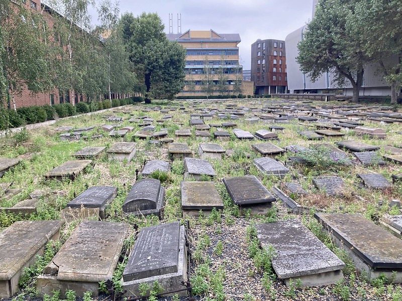
The Novo Cemetery is England’s second largest Sephardic cemetery, first used for Jewish burials in 1733, now surrounded by a university campus.
Credit: Flickr/diamond geezer
Licence:


Stepney City Farm
Credit: Wiki Commons/Adrian Scottow
Licence: CC BY 2.0


The original People’s Palace (1920s)
Credit: Wiki Commons
Licence: CC BY 2.0


Burdett Road, looking south from Bede Road (1953)
Licence:


Mile End Road, looking west from Burdett Road, E3 (1905)
Licence:


The ’Queen’ beerhouse at 128 Rhodeswell Road. Limehouse (1897). Beerhouses weren’t licenced to sell wines and spirits - only beer.
Old London postcard
Licence:


White Horse Street in the 1930s. The northern part of the long White Horse Street is now called White Horse Road.
Credit: William Whiffin
Licence:


Cottage, Mile End Place (2023)
Credit: Butler and Stag
Licence: CC BY 2.0