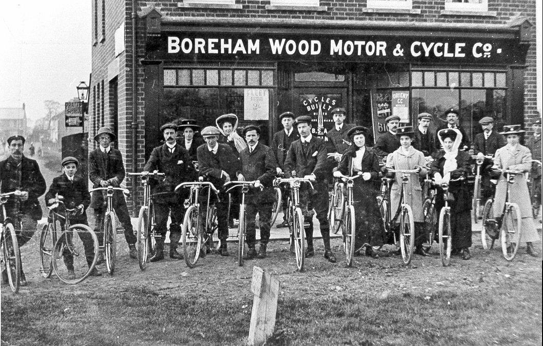
127-129 Shenley Road,
Address in/near Borehamwood, existing between 1921 and now.
| 127-129 Shenley Road, Address in/near Borehamwood, existing between 1921 and now. |
| HOME | · | ARTICLE | · | MARKERS OFF | · | STREETS | · | BLOG | · | CONTACT US |
| MAP YEAR: | 1750 | 1800 | 1810 | 1820 | 1830 | 1860 | 1900 | 1950 | 2024 | |
| TIP: To see an article about a particular location, click one of the markers on the map | ||||||||||
| Click here to explore another London street We now have 668 completed street histories and 46832 partial histories Find streets or residential blocks within the M25 by clicking STREETS |
| CONTRIBUTIONS TO THE LOCALITY |
  Irene Smith Added: 30 Jun 2017 15:46 GMT | Keystone Passage, WD6 My mother worked at Keystones in the 1940s before she was married. She later worked at home which a lot of people did. You would often see people walking around Boreham Wood with boxes filled with piecework for the factory. Reply |
| LATEST LONDON-WIDE CONTRIBUTIONS TO THE PROJECT |
  Charles Black Added: 24 May 2024 12:54 GMT | Middle Row, W10 Middle Row was notable for its bus garage, home of the number 7. Reply |
 Added: 2 May 2024 16:14 GMT | Farm Place, W8 The previous name of Farm Place was Ernest St (no A) Reply |
Tony Whipple Added: 16 Apr 2024 21:35 GMT | Frank Whipple Place, E14 Frank was my great-uncle, I’d often be ’babysat’ by Peggy while Nan and Dad went to the pub. Peggy was a marvel, so full of life. My Dad and Frank didn’t agree on most politics but everyone in the family is proud of him. A genuinely nice, knowledgable bloke. One of a kind. Reply |
 Theresa Penney Added: 16 Apr 2024 18:08 GMT | 1 Whites Row My 2 x great grandparents and his family lived here according to the 1841 census. They were Dutch Ashkenazi Jews born in Amsterdam at the beginning of the 19th century but all their children were born in Spitalfields. Reply |
Wendy Added: 22 Mar 2024 15:33 GMT | Polygon Buildings Following the demolition of the Polygon, and prior to the construction of Oakshott Court in 1974, 4 tenement type blocks of flats were built on the site at Clarendon Sq/Phoenix Rd called Polygon Buildings. These were primarily for people working for the Midland Railway and subsequently British Rail. My family lived for 5 years in Block C in the 1950s. It seems that very few photos exist of these buildings. Reply |
  Steve Added: 19 Mar 2024 08:42 GMT | Road construction and houses completed New Charleville Circus road layout shown on Stanford’s Library Map Of London And Its Suburbs 1879 with access via West Hill only. Plans showing street numbering were recorded in 1888 so we can concluded the houses in Charleville Circus were built by this date. Source: Charleville Circus, Sydenham, London Reply |
Steve Added: 19 Mar 2024 08:04 GMT | Charleville Circus, Sydenham: One Place Study (OPS) One Place Study’s (OPS) are a recent innovation to research and record historical facts/events/people focused on a single place �’ building, street, town etc. I have created an open access OPS of Charleville Circus on WikiTree that has over a million members across the globe working on a single family tree for everyone to enjoy, for free, forever. Source: Charleville Circus, Sydenham, London Reply |
Charles Added: 8 Mar 2024 20:45 GMT | My House I want to know who lived in my house in the 1860’s. Reply |
| LOCAL PHOTOS |
 |  |  |  |  |
 |  |  Locals diving from the aqueduct of the former Elstree Brickfields (1940s) TUM image id: 1524309322 Licence: |  |  |
 |  |  |  |  |