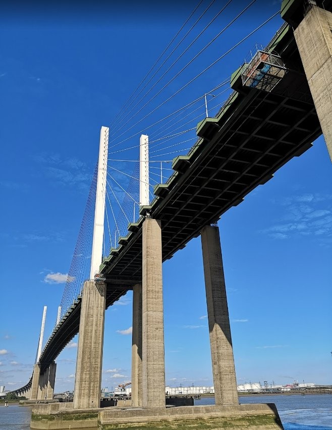
River Thames near Purfleet

Co-ordinate in/near Purfleet, existing until now.

 HOME  ·  ABOUT  ·  ARTICLE  ·  MARKERS OFF  ·  BLOG 
(51.469 0.253, 51.469 0.253) 
MAP YEAR:175018001810182018301860190019502024 
TIP: To create your own sharable map, right click on the map
 
Co-ordinate · * · RM19 ·
0


.
..

Licence: Creative Commons Attribution-ShareAlike Licence


Click here to explore another London street
We now have 670 completed street histories and 46830 partial histories
Find streets or residential blocks within the M25 by clicking STREETS

...

CONTRIBUTIONS TO THE LOCALITY

None so far :(
LATEST LONDON-WIDE CONTRIBUTIONS TO THE PROJECT

Born here
Roy Mathieson   
Added: 27 Jun 2024 16:25 GMT   

St Saviours
My great grandmother was born in Bowling Green Lane in 1848. The family moved from there to Earl Terrace, Bermondsey in 1849. I have never been able to locate Earl Terrace on maps.

Reply

   
Added: 26 Jun 2024 13:10 GMT   

Buckhurst Street, E1
Mt grandfather, Thomas Walton Ward had a musical instrument workshop in Buckhurst Street from 1934 until the street was bombed during the war. Grandfather was a partner in the musical instrument firm of R.J. Ward and Sons of Liverpool. He died in 1945 and is buried in a common grave at Abney Park Cemetery.

Reply
Lived here
Mike Dowling   
Added: 15 Jun 2024 15:51 GMT   

Family ties (1936 - 1963)
The Dowling family lived at number 13 Undercliffe Road for
Nearly 26 years. Next door was the Harris family

Reply
Comment
Evie Helen   
Added: 13 Jun 2024 00:03 GMT   

Vickers Road
The road ’Vickers Road’ is numbered rather differently to other roads in the area as it was originally built as housing for the "Vickers" arms factory in the late 1800’s and early 1900s. Most of the houses still retain the original 19th century tiling and drainage outside of the front doors.

Reply

Paul Harris    
Added: 12 Jun 2024 12:54 GMT   

Ellen Place, E1
My mother’s father and his family lived at 31 Ellen Place London E1 have a copy of the 1911 census showing this

Reply
Comment
   
Added: 10 Jun 2024 19:31 GMT   

Toll gate Close
Did anyone live at Toll Gate Close, which was built in the area where the baths had been?

Reply

Charles Black   
Added: 24 May 2024 12:54 GMT   

Middle Row, W10
Middle Row was notable for its bus garage, home of the number 7.

Reply
Comment
   
Added: 2 May 2024 16:14 GMT   

Farm Place, W8
The previous name of Farm Place was Ernest St (no A)

Reply


LOCAL PHOTOS
Click here to see map view of nearby Creative Commons images
Click here to see Creative Commons images near to this postcode
Maps of the Environs of London (1932) Seemingly one of the highlights of London tourism in 1932 was the Pears Factory in Isleworth, Middlesex, according to the only picture on this map. Before the creation of the Greater London Council in 1965, the county boundaries in the region were quirky. We dealt with the County of London a few maps back. Middlesex was the second smallest county in England but unfortunate enough to be swallowed by the urban expansion of London between the wars. It made certain administrative coordination decisions difficult, with for example Hampstead run by County Hall, London but next door Willesden run by County Hall, Brentford with Edgware Road forming the border between the two. Hammersmith on the Thames in London meanwhile was opposite Barnes, Surrey but Putney, a mile downstream, was back in London. Kent and London split the Thamesmead area. Urban Bromley was part of the former whereas rural Eltham (in 1932) part of the latter. Essex, highly built up on the fringes of the capital, stretched all the way to the River Lea. West Ham, Stratford, Barking and Romford were all not in London. Hertfordshire had a strange salient which contained Barnet and run all the way, but for 200 yards, to Southgate station. The bundling of everything into the GLC in 1965 made a lot of political sense even if it made of lot of interesting geography redundant.
Credit: George Philip and Son Ltd.
TUM image id: 1715687465
Licence:
A matter of geometry
TUM image id: 1713792388
Licence:
Facebook
TUM image id: 1713788023
Licence:

In the neighbourhood...

Click an image below for a better view...
Toll booths at the Dartford Crossing (2011)
Credit: Wiki Commons/Darren Meacher
Licence: CC BY 2.0


Littlebrook Deepwater Pier lies in the shadow of the Dartford Crossing’s Queen Elizabeth Bridge. It provided a mooring point for the nearby decommissioned Littlebrook Power Station.
Credit: Google
Licence: CC BY 2.0


Maps of the Environs of London (1932) Seemingly one of the highlights of London tourism in 1932 was the Pears Factory in Isleworth, Middlesex, according to the only picture on this map. Before the creation of the Greater London Council in 1965, the county boundaries in the region were quirky. We dealt with the County of London a few maps back. Middlesex was the second smallest county in England but unfortunate enough to be swallowed by the urban expansion of London between the wars. It made certain administrative coordination decisions difficult, with for example Hampstead run by County Hall, London but next door Willesden run by County Hall, Brentford with Edgware Road forming the border between the two. Hammersmith on the Thames in London meanwhile was opposite Barnes, Surrey but Putney, a mile downstream, was back in London. Kent and London split the Thamesmead area. Urban Bromley was part of the former whereas rural Eltham (in 1932) part of the latter. Essex, highly built up on the fringes of the capital, stretched all the way to the River Lea. West Ham, Stratford, Barking and Romford were all not in London. Hertfordshire had a strange salient which contained Barnet and run all the way, but for 200 yards, to Southgate station. The bundling of everything into the GLC in 1965 made a lot of political sense even if it made of lot of interesting geography redundant.
Credit: George Philip and Son Ltd.
Licence:


A matter of geometry
Licence:


A map a day for the month of May Political map of the County of London (1930). That section of Woolwich north of the Thames, surrounded by Essex was quite an interesting anomaly. The borough had inherited these two exclaves from Kent when the borders of the new County of London had been drawn up in 1888. They continued to make no sense whatsoever until 1965 when the arrival of the Greater London Council abolished them, assigning them to Newham.
Licence:


A map a day for the month of May This early map by Lea in 1690 shows the marshy banks of the River Thames. The north bank is solid marsh from Silvertown to Tilbury. Much of the south bank is too, but this has not been depicted so much by the cartographer.
Licence:


A map a day for the month of May I have a bit of a map collection in my possession. Throughout May, I will be publishing one old map every day. This one is an 1855 London overview best seen on a desktop computer rather than a phone - you’ll be able to zoom into your favourite area of London in reasonable detail. The original is in much better definition which I will publish sections of at some point in the future.
Credit: J.H. Colton
Licence:


Facebook
Licence:


Children enjoy themselves at a Christmas Party, on 25 December 1940, in a London underground shelter
Credit: AP
Licence: CC BY 2.0


Fortune-telling bird (1940s) - once a common sight in London markets
Credit: Walter Joseph Collection/British Library
Licence:


  Contact us · Copyright policy · Privacy policy