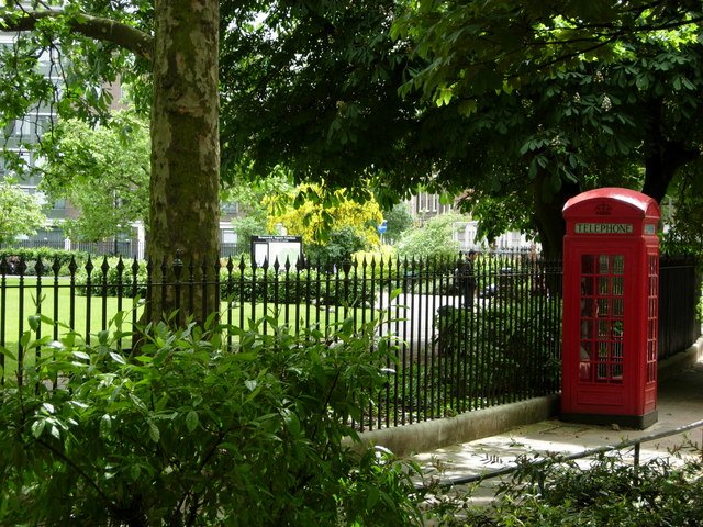
Bedford Place, WC1B

Road in/near Bloomsbury

 HOME  ·  ARTICLE  ·  MAPS  ·  STREETS  ·  BLOG  ·  CONTACT US 
(51.52023 -0.12432, 51.52 -0.124) 
MAP YEAR:175018001810182018301860190019502023Show map without markers
ZOOM:14 15 16 17 14 15 16 17 14 15 16 17 14 15 16 17 14 15 16 17 14 15 16 17 14 15 16 17 18 14 15 16 17 14 15 16 17 18
TIP: To create your own sharable map, right click on the map
Road · Bloomsbury · WC1B ·
JANUARY
1
2000

Bedford Place is one of the streets of London in the WC1B postal area.


Click here to explore another London street
We now have 612 completed street histories and 46888 partial histories
Find streets or residential blocks within the M25 by clicking STREETS


CONTRIBUTIONS TO THE LOCALITY


The Underground Map   
Added: 8 Dec 2020 00:24 GMT   

Othello takes a bow
On 1 November 1604, William Shakespeare’s tragedy Othello was presented for the first time, at The Palace of Whitehall. The palace was the main residence of the English monarchs in London from 1530 until 1698. Seven years to the day, Shakespeare’s romantic comedy The Tempest was also presented for the first time, and also at the Palace of Whitehall.

Reply
Comment
Linda Webb   
Added: 27 Sep 2021 05:51 GMT   

Hungerford Stairs
In 1794 my ancestor, George Webb, Clay Pipe Maker, lived in Hungerford Stairs, Strand. Source: Wakefields Merchant & Tradesmens General Directory London Westminster 1794

Source: Hungerford Stairs

Reply
Comment
Fumblina   
Added: 21 Feb 2023 11:39 GMT   

Error on 1800 map numbering for John Street
The 1800 map of Whitfield Street (17 zoom) has an error in the numbering shown on the map. The houses are numbered up the right hand side of John Street and Upper John Street to #47 and then are numbered down the left hand side until #81 BUT then continue from 52-61 instead of 82-91.

Reply

TUM   
Added: 27 Aug 2022 10:22 GMT   

The Underground Map
Michael Faraday successfully demonstrated the first electrical transformer at the Royal Institute, London.

Reply

Roy Batham   
Added: 7 Jan 2022 07:17 GMT   

Smithy in Longacre
John Burris 1802-1848 Listed 1841 census as Burroughs was a blacksmith, address just given as Longacre.

Source: Batham/Wiseman - Family Tree

Reply

Reg Carr   
Added: 10 Feb 2021 12:11 GMT   

Campbellite Meeting
In 1848 the Campbellites (Disciples of Christ) met in Elstree Street, where their congregation was presided over by a pastor named John Black. Their appointed evangelist at the time was called David King, who later became the Editor of the British Millennial Harbinger. The meeting room was visited in July 1848 by Dr John Thomas, who spoke there twice on his two-year ’mission’ to Britain.

Reply
Comment
Jeff Owen   
Added: 20 Mar 2021 16:18 GMT   

Owen’s School
Owen Street is the site of Owen’s Boys’ School. The last school was built in 1881 and was demolished in the early 1990s to make way for the development which stand there today. It was a “Direct Grant” grammar school and was founded in 1613 by Dame Alice Owen. What is now “Owen’s Fields” was the playground between the old school and the new girls’ school (known then as “Dames Alice Owen’s School” or simply “DAOS”). The boys’ school had the top two floors of that building for their science labs. The school moved to Potters Bar in Hertfordshire in 1971 and is now one of the top State comprehensive schools in the country. The old building remained in use as an accountancy college and taxi-drivers’ “knowledge” school until it was demolished. The new building is now part of City and Islington College. Owen’s was a fine school. I should know because I attended there from 1961 to 1968.

Reply

Scott Hatton   
Added: 11 Sep 2020 19:47 GMT   

Millions Of Rats In Busy London
The Daily Mail on 14 April 1903 reported "MILLIONS OF RATS IN BUSY LONDON"

A rat plague, unprecedented in the annals of London, has broken out on the north side of the Strand. The streets principally infested are Catherine street, Drury lane, Blackmore street, Clare Market and Russell street. Something akin to a reign of terror prevails among the inhabitants after nightfall. Women refuse to pass along Blackmore street and the lower parts of Stanhope street after dusk, for droves of rats perambulate the roadways and pavements, and may be seen running along the window ledges of the empty houses awaiting demolition by the County Council in the Strand to Holborn improvement scheme.

The rats, indeed, have appeared in almost-incredible numbers. "There are millions of them," said one shopkeeper, and his statement was supported by other residents. The unwelcome visitors have been evicted from their old haunts by the County Council housebreakers, and are now busily in search of new homes. The Gaiety Restaurant has been the greatest sufferer. Rats have invaded the premises in such force that the managers have had to close the large dining room on the first floor and the grill rooms on the ground floor and in the basement. Those three spacious halls which have witnessed many as semblages of theatre-goers are now qui:e deserted. Behind the wainscot of the bandstand in the grillroom is a large mound of linen shreds. This represents 1728 serviettes carried theee by the rats.

In the bar the removal of a panel disclosed the astonishing fact that the rats have dragged for a distance of seven or eight yards some thirty or forty beer and wine bottles and stacked them in such a fashion as to make comfortable sleeping places. Mr Williams. the manager of the restaurant, estimates that the rats have destroyed L200 worth of linen. Formerly the Gaiety Restaurant dined 2000 persons daily; no business whatever is now done in this direction.

Reply

Scott Hatton   
Added: 30 Jan 2023 11:28 GMT   

The Beatles on a London rooftop
The Beatles’ rooftop concert took place on the rooftop of the Apple Corps building in London. It was their final public performance as a band and was unannounced, attracting a crowd of onlookers. The concert lasted for 42 minutes and included nine songs. The concert is remembered as a seminal moment in the history of rock music and remains one of the most famous rock performances of all time.

Reply
Lived here
Julian    
Added: 23 Mar 2021 10:11 GMT   

Dennis Potter
Author Dennis Potter lived in Collingwood House in the 1970’s

Reply
Comment
Jessie Doring   
Added: 22 Feb 2021 04:33 GMT   

Tisbury Court Jazz Bar
Jazz Bar opened in Tisbury Court by 2 Australians. Situated in underground basement. Can not remember how long it opened for.

Reply
Lived here
Richard Roques   
Added: 21 Jan 2021 16:53 GMT   

Buckingham Street residents
Here in Buckingham Street lived Samuel Pepys the diarist, Charles Dickens and Rudyard Kipling

Reply
Comment
Jude Allen   
Added: 29 Jul 2021 07:53 GMT   

Bra top
I jave a jewelled item of clothong worn by a revie girl.
It is red with diamante straps. Inside it jas a label Bermans Revue 16 Orange Street but I cannot find any info online about the revue only that 16 Orange Street used to be a theatre. Does any one know about the revue. I would be intesrested to imagine the wearer of the article and her London life.

Reply
Comment
Lena    
Added: 18 Mar 2021 13:08 GMT   

White Conduit Street, N1
My mum, Rosina Wade of the Wade and Hannam family in the area of Chapel Street and Parkfield Street, bought her first “costume” at S Cohen’s in White Conduit Street. Would have probably been about 1936 or thereabouts. She said that he was a small man but an expert tailor. I hope that Islington Council preserve the shop front as it’s a piece of history of the area. Mum used to get her high heel shoes from an Italian shoe shop in Chapel Street. She had size 2 feet and they would let her know when a new consignment of size 2 shoes were in. I think she was a very good customer. She worked at Killingbacks artificial flower maker in Northampton Square and later at the Halifax bombers factory north of Edgware where she was a riveter.

Reply

BG   
Added: 20 Dec 2022 02:58 GMT   

Lancing Street, NW1
LANCING STREET

Reply

LATEST LONDON-WIDE CONTRIBUTIONS TO THE PROJECT

Comment
Loraine Brocklehurst    
Added: 24 May 2023 14:00 GMT   

Holcombe Road, N17
I lived at 23Holcombe Rd. with my parents, Grandfather , Aunt and Uncle in 1954. My Aunt and Uncle lived there until it was demolished. I’m not sure what year that was as we emigrated to Canada.

Reply

Jen Williams   
Added: 20 May 2023 17:27 GMT   

Corfield Street, E2
My mother was born in 193 Corfield Street in 1920.Her father was a policeman.

Reply

sofia   
Added: 19 May 2023 08:57 GMT   

43 MELLITUS STREET
43 MELLITUS STREET

Reply

   
Added: 17 May 2023 11:50 GMT   

Milson Road (1908 - 1954)
My grandparents and great grandparents and great great grandparents the Manley family lived at 33 Milson Road from 1908 to 1935. My grandad was born at 33 Milson Road. His parents George and Grace had all four of their chidren there. When his father Edward died his mother moved to 67 Milson in 1935 Road and lived there until 1954 (records found so far, it may be longer). Before that they lived in the Porten Road. I wonder if there is anyone that used to know them? My grandad was Charles ’Ted’ Manley, his parents were called George and Grace and George’s parents were called Edward and Bessie. George worked in a garage and Edward was a hairdresser.

Reply
Lived here
   
Added: 16 Apr 2023 15:55 GMT   

Rendlesham Road, E5
I lived at 14 Rendlesham Road in the 1940s and 50s. The house belonged to my grandfather James Grosvenor who bought it in the 1920s for £200.I had a brother who lived in property until 1956 when he married. Local families were the paisleys, the Jenners and the family of Christopher Gable.

Reply
Comment
Sandra Field   
Added: 15 Apr 2023 16:15 GMT   

Removal Order
Removal order from Shoreditch to Holborn, Jane Emma Hall, Single, 21 Pregnant. Born about 21 years since in Masons place in the parish of St Lukes.

Source:
Sign up


Reply
Comment
Sue Germain   
Added: 10 Apr 2023 08:35 GMT   

Southwood Road, SE9
My great great grandfather lived in Time Villa, Southwood Rd around 1901. He owned several coffee houses in Whitechapel and in South London, including New Time Coffee House so either his house was named after the coffee house or vice versa.

Reply

David Gleeson   
Added: 7 Apr 2023 22:19 GMT   

MBE from Campbell Bunk (1897 - 1971)
Walter Smith born at 43 Campbell Bunk was awarded the MBE in january honours list in 1971. A local councillor for services to the public.

Reply


NEARBY LOCATIONS OF NOTE
British Museum British Museum was a station on the Central line, located in Holborn and taking its name from the nearby British Museum in Great Russell Street.
Russell Square Russell Square station, now on London’s Piccadilly Line, was opened by the Great Northern, Piccadilly and Brompton Railway on 15 December 1906.
The Horse Hospital Built as stabling for the sick horses of cabbies, The Horse Hospital is now a unique Grade II listed arts venue in Bloomsbury.
Weston’s Music Hall Weston’s Music Hall was a music hall and theatre that opened in 1857. In 1906, the theatre became known as the Holborn Empire.

NEARBY STREETS
Adeline Place, WC1B Adeline Place was named after Adeline Marie Russell.
Africa House, WC2A Residential block
Africa House, WC2B Africa House is a block on Kingsway.
Arab Press House, WC1V Arab Press House is located on High Holborn.
Aria House, WC1V Aria House is located on Newton Street.
Artist House, WC1A Artist House is sited on Little Russell Street.
Aviation House, WC2B Aviation House is a building on Kingsway.
Bainbridge Street, WC2H Bainbridge Street takes its name from Henry Bainbridge, a local resident in the 17th century.
Barbon Close, WC1N Barbon Close lies off Great Ormond Street.
Barclay House, WC1N Barclay House is a building on Queen Square.
Barter Street, WC1A Barter Street is one of the streets of London in the WC1A postal area.
Bayley Street, WC1B Bayley Street is one of the streets of London in the WC1B postal area.
Beacon House, WC2B Beacon House is a block on Kingsway.
Bedford Avenue, WC1B Bedford Avenue is one of the streets of London in the WC1B postal area.
Bedford Court Mansions, WC1B Bedford Court Mansions is a block on Adeline Place.
Bedford Square, WC1B Bedford Square was designed as a unified architectural composition in 1775-6 by Thomas Leverton.
Bedford Way, WC1H Bedford Way is one of the streets of London in the WC1H postal area.
Bernard Street, WC1N Bernard Street is one of the streets of London in the WC1N postal area.
Bloomsbury House, WC1B Bloomsbury House is a block on Bedford Square.
Bloomsbury Place, WC1B The name of Bloomsbury Place is derived from William Blemund.
Bloomsbury Square, WC1A The 4th Earl of Southampton was granted a building license for the construction of Bloomsbury Square in 1661.
Bloomsbury Street, WC1A Bloomsbury Street runs from Gower Street in the north to the junction of New Oxford Street and Shaftesbury Avenue in the south.
Bloomsbury Way, WC1A Bloomsbury Way is one of the streets of London in the WC1A postal area.
Boswell Street, WC1N Boswell Street is one of the streets of London in the WC1N postal area.
Bristol House, WC1B Residential block
Brunswick Centre, WC1N The Brunswick Centre is a grade II listed residential and shopping centre in Bloomsbury.
Brunswick Square, WC1N Brunswick Square is the result of a sale of land by the Foundling Hospital.
Bucknall Street, WC2H Bucknall Street is one of the streets of London in the WC2H postal area.
Bury Place, WC1A Bury Place is one of the streets of London in the WC1A postal area.
Byng Place, WC1E Byng Place is a road in the WC1E postcode area
Castlewood House, WC1A Residential block
Catton Street, WC2B Catton Street is one of the streets of London in the WC1R postal area.
Centre Point, WC2H Centre Point is a controversial 1960s-built tower block.
Chenies Street, WC1E Chenies Street takes its name from the Buckinghamshire village where since 1556 members of the Russell family have been buried.
Churchill House, WC1R Churchill House is located on Red Lion Square.
Cockpit Yard, WC1X Cockpit Yard leads off Northington Street.
Colonnade, WC1N Colonnade is one of the streets of London in the WC1N postal area.
Commonwealth House, WC1V Commonwealth House is a block on New Oxford Street.
Congress House, WC1B Congress House can be found on Great Russell Street.
Coptic Street, WC2H Coptic Street is one of the streets of London in the WC1A postal area.
Coram Street, WC1N Coram Street is one of the streets of London in the WC1N postal area.
Cosmo Place, WC1B Cosmo Place is a road in the WC1B postcode area
Dane Street, WC1R Dane Street is one of the streets of London in the WC1R postal area.
Dombey Street, WC1N Dombey Street is a road in the WC1N postcode area
Doughty Mews, WC1N Doughty Mews is one of the streets of London in the WC1N postal area.
Doughty Street, WC1N Doughty Street is a broad tree-lined street in the Holborn district.
Dyott Street, WC1A Dyott Street is one of the streets of London in the WC1A postal area.
Eagle Street, WC1R Eagle Street runs parallel to High Holborn, one block north.
Emerald Street, WC1N Emerald Street is one of the streets of London in the WC1N postal area.
Faber Building, WC1H Faber Building is a block on Russell Square.
Fairgate House, WC1A Fairgate House is a block on New Oxford Street.
Field Court, WC1R Field Court is one of the streets of London in the WC1R postal area.
Fisher Street, WC1R Fisher Street is one of the streets of London in the WC1R postal area.
Galen Place, WC1A Galen Place is one of the streets of London in the WC1A postal area.
Gate Street, WC2A Gate Street is one of the streets of London in the WC2A postal area.
Gilbert Place, WC1A Gilbert Place is one of the streets of London in the WC1A postal area.
Gloucester Road, WC1N Gloucester Road is one of the streets of London in the WC1N postal area.
Gordon Square, WC1H The completion of Thomas Cubitt’s Gordon Square in 1860 marked the final development of Bloomsbury.
Grape Street, WC2H Grape Street is one of the streets of London in the WC2H postal area.
Great James Street, WC1N Great James Street is one of the streets of London in the WC1N postal area.
Great Ormond Street, WC1N Great Ormond Street is one of the streets of London in the WC1N postal area.
Great Russell Street, WC1A Great Russell Street commemorates the marriage of the daughter of the 4th Earl of Southampton to William Russell in 1669.
Green Dragon House, WC2B Green Dragon House is a block on Stukeley Street.
Grenville Street, WC1N Grenville Street is one of the streets of London in the WC1N postal area.
Guilford Street, WC1B Guilford Street is a road in the WC1B postcode area
Guilford Street, WC1N Guilford Street is one of the streets of London in the WC1N postal area.
Hanway Place, W1T Hanway Place is one of the streets of London in the W1T postal area.
Hanway Street, W1D Hanway Street was named after Major John Hanway.
Herbrand Street, WC1N Herbrand Street is in the east of Bloomsbury, running south from Tavistock Place to Guilford Street.
High Holborn, WC1V High Holborn was part of the old road from Newgate and the Tower to the gallows at Tyburn.
High Holborn, WC2B High Holborn is a road which is the highest point in the City of London - 22 metres above sea level.
Holborn Tower, WC1V Holborn Tower is a building on High Holborn.
Isis House, WC1A Isis House is a building on New Oxford Street.
Keppel Street, WC1E Keppel Street links Store Street and Gower Street in the west to Malet Street in the east.
Kingsgate Est, WC1B A street within the WC1B postcode
Kingsgate Street, WC1R Kingsgate Street ran from High Holborn to Theobald’s Road.
Kirk Street, WC1N Kirk Street is one of the streets of London in the WC1N postal area.
Lacon House, WC1X Lacon House is a block on Theobald’s Road.
Lamb’s Conduit Passage, WC1R This is a street in the WC1R postcode area
Lamb’s Conduit Street, WC1N This is a street in the WC1N postcode area
Lamb’s Mews, WC1N Lamb’s Mews is a road in the N1 postcode area
Lamp Office Court, WC1N Lamp Office Court is one of the streets of London in the WC1N postal area.
Leverton House, WC1B Leverton House is a block on Bedford Square.
Lincoln’s Inn Fields, WC2A Lincoln’s Inn Fields is the largest public square in London, laid out in the 1630s under the initiative of the speculative builder William Newton.
Lion Court, WC1R Lion Court is one of the streets of London in the WC1V postal area.
Lion House, WC1V Lion House is a block on Red Lion Street.
Little Guildford Street, WC1N Little Guildford Street was the middle part of what is now Herbrand Street, between Great Coram Street and Bernard Street, on the western edge of the Foundling estate.
Little Russel Street, WC1A Little Russel Street is one of the streets of London in the WC1A postal area.
Little Russell Street, WC1A Little Russell Street is one of the streets of London in the WC1A postal area.
Little Turnstile, WC2A Little Turnstile is one of the streets of London in the WC1V postal area.
Long Yard, WC1N Long Yard is one of the streets of London in the WC1N postal area.
Malet Street, WC1E Sir Edward Malet was married to Lady Ermyntrude Sackville Russell, daughter of Francis Russell who owned much of the surrounding area.
Millman Place, WC1N Millman Place is a road in the WC1N postcode area
Millman Street, WC1N Millman Street is one of the streets of London in the WC1N postal area.
Montague Place, WC1E Montague Place was developed in the decade after 1800.
Montague Street, WC1B Montague Street is one of the streets of London in the WC1B postal area.
Morwell Street, WC1B Morwell Street is a road in the WC1B postcode area
Museum House, WC1A Museum House is a block on Museum Street.
Museum Street, WC1A Museum Street is so-named since it approaches the main entrance of the British Museum.
Neals Yard, WC1N Neals Yard is one of the streets of London in the WC1N postal area.
New North Street, WC1N New North Street is one of the streets of London in the WC1N postal area.
New Oxford Street, WC1A New Oxford Street was built in 1840 to ease congestion in St Giles High Street.
New Oxford Street, WC2H New Oxford Street is a road in the WC2H postcode area
Newton Street, WC1V Newton Street is named for Isaac Newton, scientist and mathematician.
Nicolas Cooper House, WC1E Nicolas Cooper House is a block on Chenies Street.
Old Glocester Street, WC1N Old Glocester Street is one of the streets of London in the WC1N postal area.
Old Gloucester Street, WC1N Old Gloucester Street is one of the streets of London in the WC1N postal area.
Old Glouster Street, WC1N Old Glouster Street is one of the streets of London in the WC1N postal area.
Orange Street, WC1R Orange Street disappeared from the map to be replaced by St Martin’s College of Art (now Central Saint Martins).
Orde Hall Street, WC1N Orde Hall Street is one of the streets of London in the WC1N postal area.
Ormond Close, WC1N Ormond Close is a road in the WC1N postcode area
Parker Tower, WC2B Parker Tower is a block on Parker Street.
Parnell House, WC1 Parnell House is a block on Streatham Street.
Parnell House, WC1A Parnell House is a block on Streatham Street.
Pied Bull Court, WC1A Pied Bull Court is one of the streets of London in the WC1A postal area.
Pied Bull Yard, WC1A Pied Bull Yard is one of the streets of London in the WC1A postal area.
Powis Place, WC1N Powis Place is a road in the WC1N postcode area
Princeton Street, WC1R Princeton Street is one of the streets of London in the WC1R postal area.
Procter Street, WC1V Procter Street is one of the streets of London in the WC1V postal area.
Proctor Street, WC1V Proctor Street is one of the streets of London in the WC1V postal area.
Queen Annes Square, WC1N Queen Annes Square is a road in the SE1 postcode area
Queen Square, WC1N Queen Square was laid out by speculator Nicholas Barbon.
Raymond Buildings, WC1R Raymond Buildings is one of the streets of London in the WC1R postal area.
Red Lion Square, WC1R Red Lion Square was built from the late 1680s by speculator Nicholas Barbon.
Red Lion Street, WC1R Red Lion Street connects High Holborn with Theobalds Road.
Richbell Place, WC1N Richbell Place is one of the streets of London in the WC1N postal area.
Ridgmount Gardens, WC1E Ridgmount Gardens is one of the streets of London in the WC1E postal area.
Ridgmount Street, WC1E Ridgmount Street is one of the streets of London in the WC1E postal area.
Roberts Engineering Building, WC1E Roberts Engineering Building is sited on Torrington Place.
Rugby Chambers, WC1N Rugby Chambers is one of the streets of London in the WC1N postal area.
Rugby Street, WC1N Rugby Street is one of the streets of London in the WC1N postal area.
Ruskin House, WC1A Ruskin House is a block on Museum Street.
Russell Court, WC1B Russell Court is one of the streets of London in the WC1H postal area.
Russell Square House, WC1B Residential block
Russell Square, WC1B Russell Square was laid out from 1800 by James Burton following the demolition of Bedford House, which originally stood on the site surrounded by gardens and fields.
Sandland Street, WC1R Sandland Street is one of the streets of London in the WC1R postal area.
Sicilian Avenue, WC1V Sicilian Avenue is a shopping parade that diagonally runs in between Southampton Row and Bloomsbury Way.
South Cloisters, WC1H South Cloisters is a road in the WC1H postcode area
Southampton Place, WC1A Southampton Place is one of the streets of London in the WC1A postal area.
Southampton Row, WC1B Southampton Row is one of the streets of London in the WC1B postal area.
Southampton Row, WC1V Southampton Row is a road in the WC1V postcode area
St George’s House, WC1A St George’s House is a block on Coptic Street.
Stedham Place, WC2H Stedham Place is one of the streets of London in the WC1A postal area.
Stewart House, WC1B Stewart House can be found on Russell Square.
Store Street, WC1E Store Street is one of the streets of London in the WC1E postal area.
Streatham Street, WC1A Streatham Street is one of the streets of London in the WC1A postal area.
Stukeley Street, WC2B Stukeley Street is one of the streets of London in the WC2B postal area.
Summit House, WC1R Summit House is a block on Red Lion Square.
Tailor House, WC1N Tailor House is a block on Colonnade.
Theobald’s Road, WC1N Theobald’s Road is a road in the WC1R postcode area
Theobalds Road, WC1N Theobalds Road is one of the streets of London in the WC1X postal area.
Thornhaugh Street, WC1B Thornhaugh Street is a street in London
Torrington Square, WC1H Torrington Square was originally laid out as part of the Bedford Estate development in 1821-25.
Tybalds Close, WC1N Tybalds Close is a location in London.
Variety Club Building, WC1N Variety Club Building is a block on Powis Place.
Verulam Buildings, WC1R Verulam Buildings is one of the streets of London in the WC1R postal area.
Victoria House, WC1B Victoria House is a block on Southampton Row.
West Central Street, WC2H West Central Street is one of the streets of London in the WC1A postal area.
Weston House, WC1V Weston House is located on High Holborn.
Whetstone Park, WC2A Whetstone Park is a road in the WC2A postcode area
Willoughby Street, WC1B Willoughby Street was formerly known as both Vine Street and Wooburn Street.
Witley Court, WC1H Witley Court is one of the streets of London in the WC1N postal area.
Woburn Mews, WC1H Woburn Mews ran parallel between Woburn Place and Upper Bedford Place to the west of Woburn Place.
Woburn Place, WC1H Woburn Place is situated on the Bedford estate, running north from the east of Russell Square to the east of Tavistock Square.
Woburn Square, WC1H Woburn Square is just north of the centre of Bloomsbury.
Yorkshire Grey Yard, WC1V Yorkshire Grey Yard lies off of Eagle Street, WC1

NEARBY PUBS
All Bar One Holborn This is a bar which was still existing in 2018.


Click here to explore another London street
We now have 557 completed street histories and 46943 partial histories


Bloomsbury

Bloomsbury is an area of the London Borough of Camden, in central London, between Euston Road and Holborn, developed by the Russell family in the 17th and 18th centuries into a fashionable residential area.

The earliest record of what would become Bloomsbury is the 1086 Domesday Book, which records that the area had vineyards and ’wood for 100 pigs’. But it is not until 1201 that the name Bloomsbury is first noted, when William de Blemond, a Norman landowner, acquired the land.

The name Bloomsbury is a development from Blemondisberi – the bury, or manor, of Blemond. An 1878 publication, Old and New London: Volume 4, mentions the idea that the area was named after a village called Lomesbury which formerly stood where Bloomsbury Square is now, though this piece of folk etymology is now discredited.

At the end of the 14th century Edward III acquired Blemond’s manor, and passed it on to the Carthusian monks of the London Charterhouse, who kept the area mostly rural.

In the 16th century, with the Dissolution of the Monasteries, Henry VIII took the land back into the possession of the Crown, and granted it to Thomas Wriothesley, 1st Earl of Southampton.

In the early 1660s, the Earl of Southampton constructed what eventually became Bloomsbury Square. The area was laid out mainly in the 18th century, largely by landowners such as Wriothesley Russell, 3rd Duke of Bedford, who built Bloomsbury Market, which opened in 1730. The major development of the squares that we see today started in about 1800 when Francis Russell, 5th Duke of Bedford removed Bedford House and developed the land to the north with Russell Square as its centrepiece.

Historically, Bloomsbury is associated with the arts, education, and medicine. The area gives its name to the Bloomsbury Group of artists, the most famous of whom was Virginia Woolf, who met in private homes in the area in the early 1900s, and to the lesser known Bloomsbury Gang of Whigs formed in 1765 by John Russell, 4th Duke of Bedford.

The publisher Faber & Faber used to be located in Queen Square, though at the time T. S. Eliot was editor the offices were in Tavistock Square. The Pre-Raphaelite Brotherhood was founded in John Millais’s parents’ house on Gower Street in 1848.

The Bloomsbury Festival was launched in 2006 when local resident Roma Backhouse was commissioned to mark the re-opening of the Brunswick Centre, a residential and shopping area.


LOCAL PHOTOS
Click here to see map view of nearby Creative Commons images
Click here to see Creative Commons images near to this postcode
Click here to see Creative Commons images tagged with this road (if applicable)
Transmission
TUM image id: 1509553463
Licence: CC BY 2.0
The British Library
TUM image id: 1482066417
Licence: CC BY 2.0
Tottenham Court Road (1927)
TUM image id: 1556973109
Licence: CC BY 2.0
Cromer Street
TUM image id: 1547917827
Licence:

In the neighbourhood...

Click an image below for a better view...
Tottenham Court Road (1927)
Licence: CC BY 2.0


British Museum station
Credit: London Transport Museum
Licence:


Centre Point, a controversial building in New Oxford Street comprising a 34-storey tower (2005) Constructed from 1963 to 1966, it was one of the first skyscrapers in London, and as of 2009 was the city’s joint 27th-tallest building. It stood empty from the time of its completion until 1975. In 2015 it was converted from office space to luxury flats.
Credit: Wiki Commons
Licence:


Muffin Man (1910) Probably this location is not ’Drury Lane’, but it is at least somewhere in London
Credit: Bishopsgate Institute
Licence:


View of Seven Dials, looking up Little Earl Street - now part of Earlham Street - in 1896
Old London postcard
Licence:


Endell Street towards Long Acre, 2015
Credit: Philafrenzy
Licence: CC BY 2.0


View of the centre of Gordon Square (2008) The square was developed by master builder Thomas Cubitt in the 1820s, as one of a pair with Tavistock Square, which is a block away and has the same dimensions.
Credit: Flickr/Ewan-M
Licence:


Decorators and Pencil Works, Great Queen Street, c.1910
Credit: Bishopsgate Institute
Licence: CC BY 2.0


Confectionery Shop, corner of Greek St and Shaftesbury Ave, c. 1930
Credit: Bishopsgate Institute
Licence: CC BY 2.0


Neal’s Yard
Credit: IG/onthere
Licence:


Print-friendly version of this page

  Contact us · Copyright policy · Privacy policy